General Information
Number of participants: 2
Number of days: 13
Water Level: Low at the top flooding by the end.
Trip Dates: Two weeks at the beginning of September
Total KM: 175
Total Elevation drop: 1900ft
Maps used: 1:50000 (22P/12, 22 P/5, 22 P/4, 22 I/13)
Gauge: No gauge, but the Moisie river gauge could be helpful in determining what the area is doing. http://www.cehq.gouv.qc.ca/Suivihydro/graphique.asp?NoStation=072301
General weather: Hot for the start of September, then we got a biblical down pour and things began to get cooler
Pace of trip: Relaxed? we gained two days with having short days so took a rest day. Then it became very much not relaxed, but we still finished a day ahead of schedule. That being said the rain did help with the 'flats at the end of the trip'
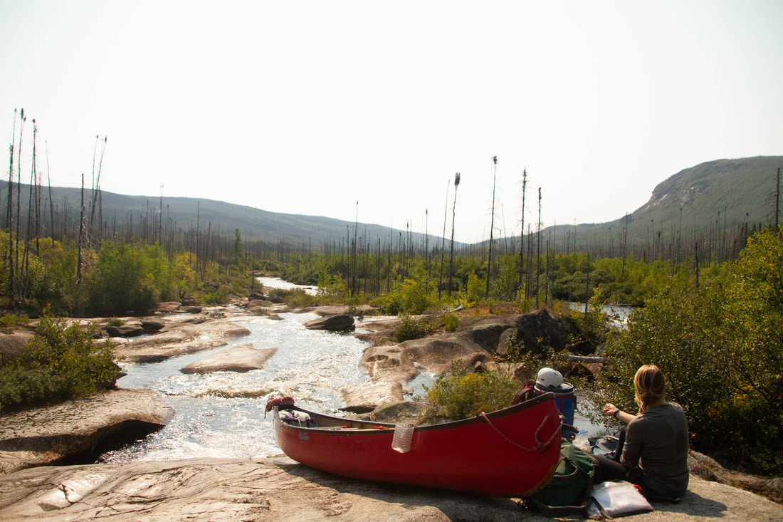
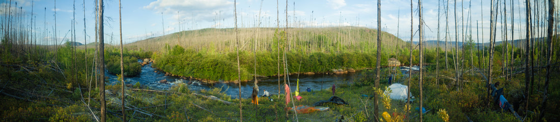
Campsites: Mostly burn sites throughout the trip, we could always find a cozy burn den, although some sights where more cozy then others. Lots of burn on the Kach so it made camping a little easier, From the Wacouno down its all gravel bar camping. Important Note there is now a cut very small tent sight RL before the first rapid in the train tracks section.
Route overview: There three main approaches to the Moisie river. They are the Pekans river, the traditional lake approach and the Ashuanipi crossover approach. We opted for a new and exciting entrance, it did not go very well.
1) The Kachipitonkas river
The 'Kach' starts around 2000ft, at the brink of the mountains and the central Quebec plateau. From there it meanders through lakes slowly building in volume. The river here is reminiscent of an alpine creek. It is continuous boulder gardens, few eddies and lots of opportunities to pin a canoe. After Lac Kachipitonkas the River picks up a bit of steam a descends through a beautiful valley, here the character begins to change there is a bit more exposed bed rock and the lines are much clearer. Once in the canyon the river changes again, it gets very rocky, and finally the caves and sieves begin to show. The last two rapids exciting the canyon are tell tail of what is to come for the next two kilometers. From the big bend to the confluence falls expect lots of sieves, caves, undercuts and boulder gardens spaced between shitty falls. There is one very large falls in this section (Land Bridge) this will be a mandatory portage for all craft. After Land Bridge the river has some high quality bed rock all the way to the confluence falls (not so great)
2) The Wacouno, Nipissis, Moisie
The Wacouno has a high quality continuous big water section for about 8ish km you can scout most of the big rapids on the train. There is one blind left hand corner you cant scout by train. It goes, Just get out early. The Nipissis is a beautiful float in an amazing valley there is one portage (you can see it from the train). To read more about the Moisie click Here
Crossover Overview: The portage is a Quebec bush bash, it starts great and progressively gets worse
Whitewater overview: The Kachipitonkas is not that great, that being said there are some great moments. Very much an alpine creek, fast and rocky. Some of it goes, some does not. in the upper section little more water and more would be runable, but it would be way faster. The lower section is out to lunch, it needs water to be more kayak friendly but less water for canoes. Should you do it? There are a lot of other rivers you should do first. However, If you are looking for an adventure..."you do you boo" The Wacouno bellow the confluance on the other hand as some very high quality class 3/4! It is very good! The Moisie speaks for its self
Schedule: We planned on going for 14 days. In the upper section we gain 2 days and took a rest day. The Canyon went a little slower then expected (but might go faster with this knowledge). We also went faster on the 'flats' because of the high water.
Sept Iles: Great Town to Start an expedition in. It has everything that you would need, Walmart, Tims Ext. Hot Tip, Gino's has really good pizza, but Marcos in Baie Comeau is better. To sleep; there is a wide variety of hotels and motels, a thriving Tinder scene, the Walmart parking lot, and a quiet little park near the train station.
The Train: Take it!!! it is so beautiful out there, never once was our group board. The train ride is absolutely stunning. The flat water is not really that bad (although it can get quite windy), and It also gives you time to figure out your systems for your group; morning rituals, packing your boat and how your boat feels fully loaded. Lastly: YOU HAVE TO EARN YOUR TURNS!!! nuff said.
You take the train from Sept Iles to 111.5 (a few km after Chico) explain to the driver where you need to go, they will figure it out. Train ticket was 20 or 30$ per person, the canoe was 150$
Number of participants: 2
Number of days: 13
Water Level: Low at the top flooding by the end.
Trip Dates: Two weeks at the beginning of September
Total KM: 175
Total Elevation drop: 1900ft
Maps used: 1:50000 (22P/12, 22 P/5, 22 P/4, 22 I/13)
Gauge: No gauge, but the Moisie river gauge could be helpful in determining what the area is doing. http://www.cehq.gouv.qc.ca/Suivihydro/graphique.asp?NoStation=072301
General weather: Hot for the start of September, then we got a biblical down pour and things began to get cooler
Pace of trip: Relaxed? we gained two days with having short days so took a rest day. Then it became very much not relaxed, but we still finished a day ahead of schedule. That being said the rain did help with the 'flats at the end of the trip'
Campsites: Mostly burn sites throughout the trip, we could always find a cozy burn den, although some sights where more cozy then others. Lots of burn on the Kach so it made camping a little easier, From the Wacouno down its all gravel bar camping. Important Note there is now a cut very small tent sight RL before the first rapid in the train tracks section.
Route overview: There three main approaches to the Moisie river. They are the Pekans river, the traditional lake approach and the Ashuanipi crossover approach. We opted for a new and exciting entrance, it did not go very well.
1) The Kachipitonkas river
The 'Kach' starts around 2000ft, at the brink of the mountains and the central Quebec plateau. From there it meanders through lakes slowly building in volume. The river here is reminiscent of an alpine creek. It is continuous boulder gardens, few eddies and lots of opportunities to pin a canoe. After Lac Kachipitonkas the River picks up a bit of steam a descends through a beautiful valley, here the character begins to change there is a bit more exposed bed rock and the lines are much clearer. Once in the canyon the river changes again, it gets very rocky, and finally the caves and sieves begin to show. The last two rapids exciting the canyon are tell tail of what is to come for the next two kilometers. From the big bend to the confluence falls expect lots of sieves, caves, undercuts and boulder gardens spaced between shitty falls. There is one very large falls in this section (Land Bridge) this will be a mandatory portage for all craft. After Land Bridge the river has some high quality bed rock all the way to the confluence falls (not so great)
2) The Wacouno, Nipissis, Moisie
The Wacouno has a high quality continuous big water section for about 8ish km you can scout most of the big rapids on the train. There is one blind left hand corner you cant scout by train. It goes, Just get out early. The Nipissis is a beautiful float in an amazing valley there is one portage (you can see it from the train). To read more about the Moisie click Here
Crossover Overview: The portage is a Quebec bush bash, it starts great and progressively gets worse
Whitewater overview: The Kachipitonkas is not that great, that being said there are some great moments. Very much an alpine creek, fast and rocky. Some of it goes, some does not. in the upper section little more water and more would be runable, but it would be way faster. The lower section is out to lunch, it needs water to be more kayak friendly but less water for canoes. Should you do it? There are a lot of other rivers you should do first. However, If you are looking for an adventure..."you do you boo" The Wacouno bellow the confluance on the other hand as some very high quality class 3/4! It is very good! The Moisie speaks for its self
Schedule: We planned on going for 14 days. In the upper section we gain 2 days and took a rest day. The Canyon went a little slower then expected (but might go faster with this knowledge). We also went faster on the 'flats' because of the high water.
Sept Iles: Great Town to Start an expedition in. It has everything that you would need, Walmart, Tims Ext. Hot Tip, Gino's has really good pizza, but Marcos in Baie Comeau is better. To sleep; there is a wide variety of hotels and motels, a thriving Tinder scene, the Walmart parking lot, and a quiet little park near the train station.
The Train: Take it!!! it is so beautiful out there, never once was our group board. The train ride is absolutely stunning. The flat water is not really that bad (although it can get quite windy), and It also gives you time to figure out your systems for your group; morning rituals, packing your boat and how your boat feels fully loaded. Lastly: YOU HAVE TO EARN YOUR TURNS!!! nuff said.
You take the train from Sept Iles to 111.5 (a few km after Chico) explain to the driver where you need to go, they will figure it out. Train ticket was 20 or 30$ per person, the canoe was 150$
Trip Report
Day 1
HoT: 7:40 to 120
HoW: 12-530
Distance: km
Weather: Mild, mix sun and cloud
Campsite: 110 145 22P/ (end of portage)
Tech
Day 2
HoW: 940-3
Distance: 16km
Weather: hot and still
Campsite: 063 981 22 P/5
Synopsis:
All creeks went but had to lift over multiple times. Also there was current in the creek
Tech
Day 3
HoW: 930-3
Distance: 16km
Weather: Overcast, rain in the afternoon
Campsite: 073 834
Synopsis:
It all kinda goes...sort of?
Tech
Day 4
HoW: 1030-4
Distance: 12km
Weather: mix of sun and cloud
Campsite: 016 707 22 P/4
Synopsis:
1) Very much an alpine creek, fast and rocky. At our water level, some of it goes, some does not. A little more water and more would be runnable, but it would be way faster.
2) We took a conservative approach since we where alone and did not know what was around the corner. A lot more would be runnable with this knowledge
Tech:
Day 5
HoW: 930-3
Distance: 8km
Weather: blue bird
Campsite: 990 633 (last available site)
Synopsis:
There is some very fun read and run ww in there
Tech:
Day 6
Rest day
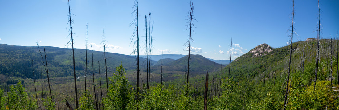
Hiked up the large prominant mountain RR to see the area. We did not get to the top because of the heat, but the views where nice
Day 7
HoW: 10-4
Distance: 2.5km
Weather: mix of sun and cloud
Campsite: 970 504
Synopsis:
The first part goes, the last part sucks dick!
Tech
Day 8
HoW: 10-4
Distance: 1.5km
Weather: rain in the morning, clearing throughout the day
Campsite: 962 591
Tech:
Day 9
HoW: 9-430
Distance: 3.5km
Weather: Rain all day
Campsite: 984 550
Tech:
Day 10
HoW: 10-430
Distance: 16km
Weather: Very cold and rainy
Campsite: 923 417 top of small island, first available camping after the wacouno joins the nipissis
Tech:
Day 11
HoW: 10-4
Distance: ?
Weather: rain in the morning, clearing before noon
Campsite: ? Camped some where on the Nipissis
Day 12
HoW: 10-4?
Distance: ?
Weather: sunny and cool
Campsite: above the first the first rapid on train tracks section RL. There is a new established camp there that could fit maybe 2 more tents?
Synopsis:
The River has been rising the last few days, it is now quite high
Tech:
The falls that you can see from the train. We portaged on the tracks RL not great as we had to lower our boat down to the river.
Day 13
HoW: 940-530
Distance: 20km
Weather: Sunny and warm
Campsite: the end!
Synopsis:
The River was way too high to run alone and in our tiny little canoe. We checked the Moisie gauge later and it hit an all time high of
over 1100 cms to give you an idea the average for that day was 340 cms. we portaged the all the way to the bottom of tressel rapids and ran the mandatory R4 after the train trestle. Is it canoeable at those flows? Yeah, for the right type of people.
Day 1
HoT: 7:40 to 120
HoW: 12-530
Distance: km
Weather: Mild, mix sun and cloud
Campsite: 110 145 22P/ (end of portage)
Tech
- got off at mile 111.5. Its after Chico. There is a trail down to a creek that flows in to the lake, You could also take the creek down to the lake. We took the portage trail, the trail is about 500m and took us an hour. It may be faster to take the creek.
- Started cross over at: 123 156 (southern end bellow creek). Ended at approximately: 110 146. 40% good 40% bad 20% shit. Top of the lake is bad, towards the little peninsula it gets better.
Day 2
HoW: 940-3
Distance: 16km
Weather: hot and still
Campsite: 063 981 22 P/5
Synopsis:
All creeks went but had to lift over multiple times. Also there was current in the creek
Tech
- creek at 113 128 - good two beaver dams
- creek at 106 106 - good some rocks to liftover
- creek at 105 095 - lift over
- creek at 100 065 - lift over
- creek at 100 036 - dragged down rocky swift
Day 3
HoW: 930-3
Distance: 16km
Weather: Overcast, rain in the afternoon
Campsite: 073 834
Synopsis:
It all kinda goes...sort of?
Tech
- creek at the end of Lac Dufresne is very rocky and creek like. We portaged once at the start and once towards the end, everything else we lined / dragged. it took approximately 2 hours
- creek out of lac croissant is much more runnable. We lined at the start but ran pretty much everything else.
Day 4
HoW: 1030-4
Distance: 12km
Weather: mix of sun and cloud
Campsite: 016 707 22 P/4
Synopsis:
1) Very much an alpine creek, fast and rocky. At our water level, some of it goes, some does not. A little more water and more would be runnable, but it would be way faster.
2) We took a conservative approach since we where alone and did not know what was around the corner. A lot more would be runnable with this knowledge
Tech:
- 070 830 Action starts a little above this. Continuous class 2/3 boulder gardens, lots of lining and little bit of paddling
- R3 065 822 RR of island, lined until we could run
- very runnable class 2/3 till somewhere around 062 814
- R3 last laugh 053 812 flows into continuous mountain style river
- R3 051 799 2 big holes
- end of mountain river 052 794 flows into...
- Royal ride till 048 783
Day 5
HoW: 930-3
Distance: 8km
Weather: blue bird
Campsite: 990 633 (last available site)
Synopsis:
There is some very fun read and run ww in there
Tech:
- R3 slide 009 689 we lined but it is totally runnable
- read and run R2/3 till...
- R3/4 005 674 portage RR flows into...
- The fingers R3/4 (5) slides and ledges from 004 672. Ferried to RL then ran down to center island, portaged to bottum through burn
- R3/4 003 669 lined river left flows into
- R2/3 read and run slowing into royal ride
- R 2/3 996 650- 994 644 we lined once
Day 6
Rest day
Hiked up the large prominant mountain RR to see the area. We did not get to the top because of the heat, but the views where nice
Day 7
HoW: 10-4
Distance: 2.5km
Weather: mix of sun and cloud
Campsite: 970 504
Synopsis:
The first part goes, the last part sucks dick!
Tech
- R4 988 630 portage RL
- R3 tech 987 629 lined RL of island, easy flows into
- Continuous R1/2 (3)
- R3 log Jam rapids 980 620 the log jam is not in play but is the identifier the you have arrived
- more of the same
- R2 675 610 too many boulders, had to line a lot
- R4 portage RR 974 505
- R5 boulder garden lined and portaged RL, real shit
- R5 boulder garden (tomorrows problem)
Day 8
HoW: 10-4
Distance: 1.5km
Weather: rain in the morning, clearing throughout the day
Campsite: 962 591
Tech:
- portaged gear to bottom of the canyon
- ran canyon (3.5hrs) should have portaged. All class 3/4 (5) lots of sieves
- ran RL Chanel of island 963 595 good lining. RR is R3/4
Day 9
HoW: 9-430
Distance: 3.5km
Weather: Rain all day
Campsite: 984 550
Tech:
- R3 962 591
- R5 Super cave 963 587 portaged gear RL portaged boat RR as it was shit on RL. right after....
- R3 Portage RR on creek bed then cut through woods to end of drop. Royal ride till end of island
- R 3/4 978 590 - 981 554
- Unrunnable sieve, slot, cave, undercut slide (land bridge) 981 554 portage RL
- walked across land bridge to RR portaged to campsite (portaged around R4/5)
Day 10
HoW: 10-430
Distance: 16km
Weather: Very cold and rainy
Campsite: 923 417 top of small island, first available camping after the wacouno joins the nipissis
Tech:
- R3 from campsite till 983 548 (we ran RR of island)
- R4/5 till 983 545
- lined RL channel at 984 545 till...
- R5 confluence falls 983 544 Portaged RL
- main flow of the Wacouno river enters at 984 541
- stopped looking at maps/ having maps from here to the end of trip all whitewater you can scout on the wacouno is c2/3(4) fun continuous big water. It was all boat scout able, except for a blind corner where we scouted RL. It went and was class 3.
Day 11
HoW: 10-4
Distance: ?
Weather: rain in the morning, clearing before noon
Campsite: ? Camped some where on the Nipissis
Day 12
HoW: 10-4?
Distance: ?
Weather: sunny and cool
Campsite: above the first the first rapid on train tracks section RL. There is a new established camp there that could fit maybe 2 more tents?
Synopsis:
The River has been rising the last few days, it is now quite high
Tech:
The falls that you can see from the train. We portaged on the tracks RL not great as we had to lower our boat down to the river.
Day 13
HoW: 940-530
Distance: 20km
Weather: Sunny and warm
Campsite: the end!
Synopsis:
The River was way too high to run alone and in our tiny little canoe. We checked the Moisie gauge later and it hit an all time high of
over 1100 cms to give you an idea the average for that day was 340 cms. we portaged the all the way to the bottom of tressel rapids and ran the mandatory R4 after the train trestle. Is it canoeable at those flows? Yeah, for the right type of people.
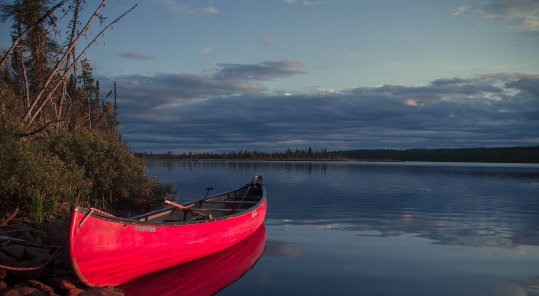
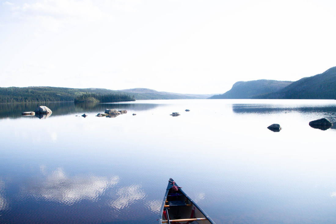
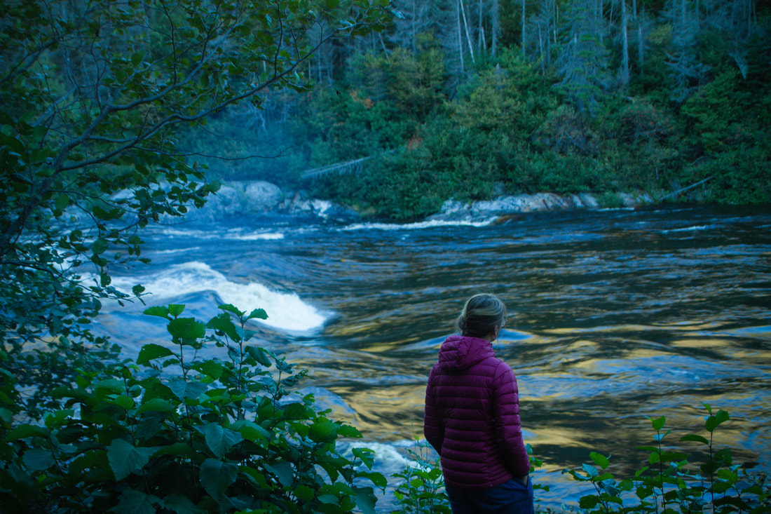
calm lake after the portage from lac Wacouno
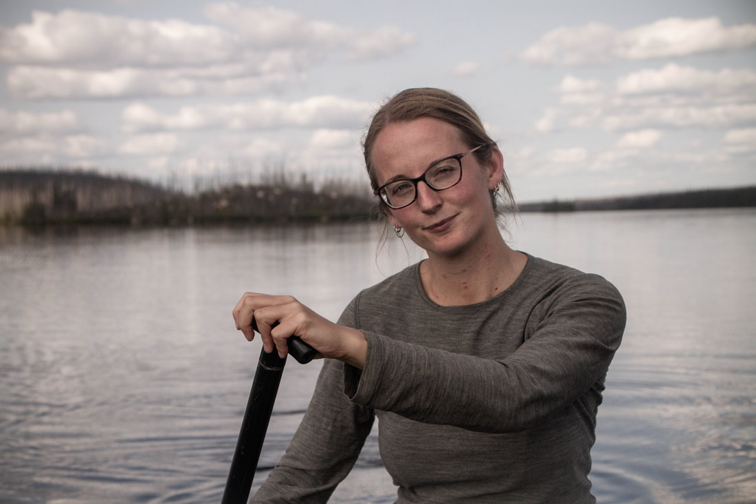
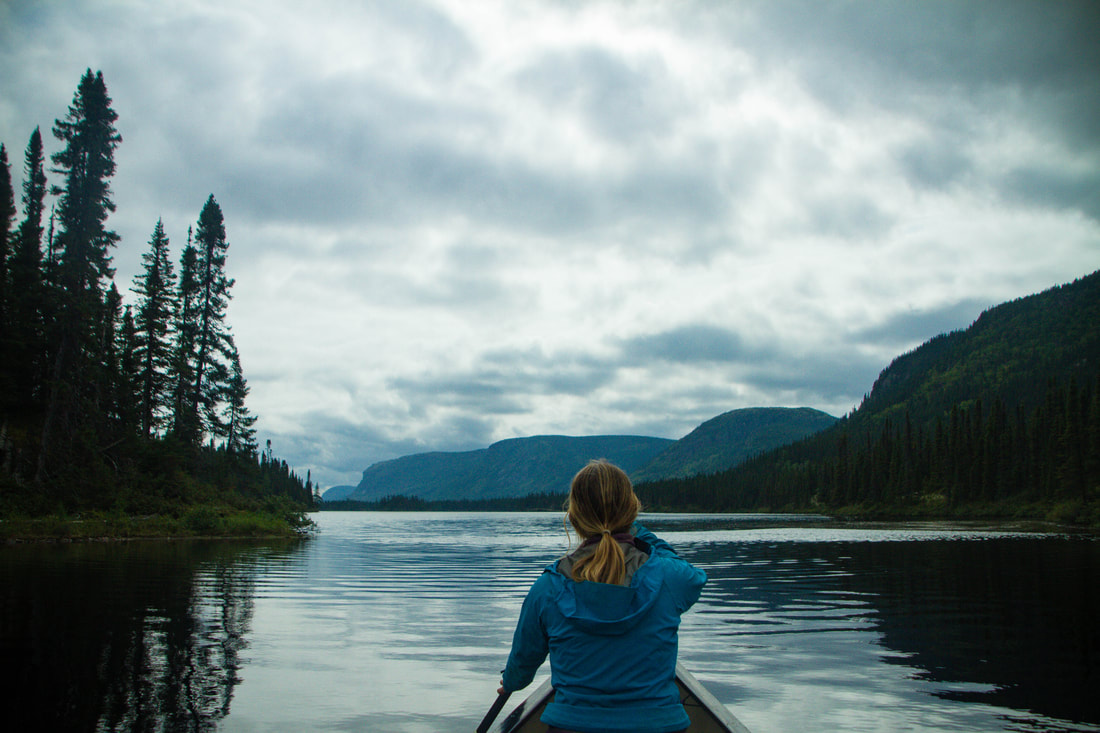
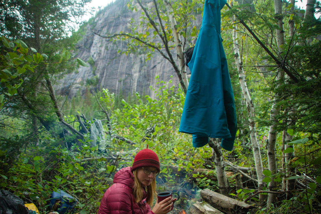
Alicia
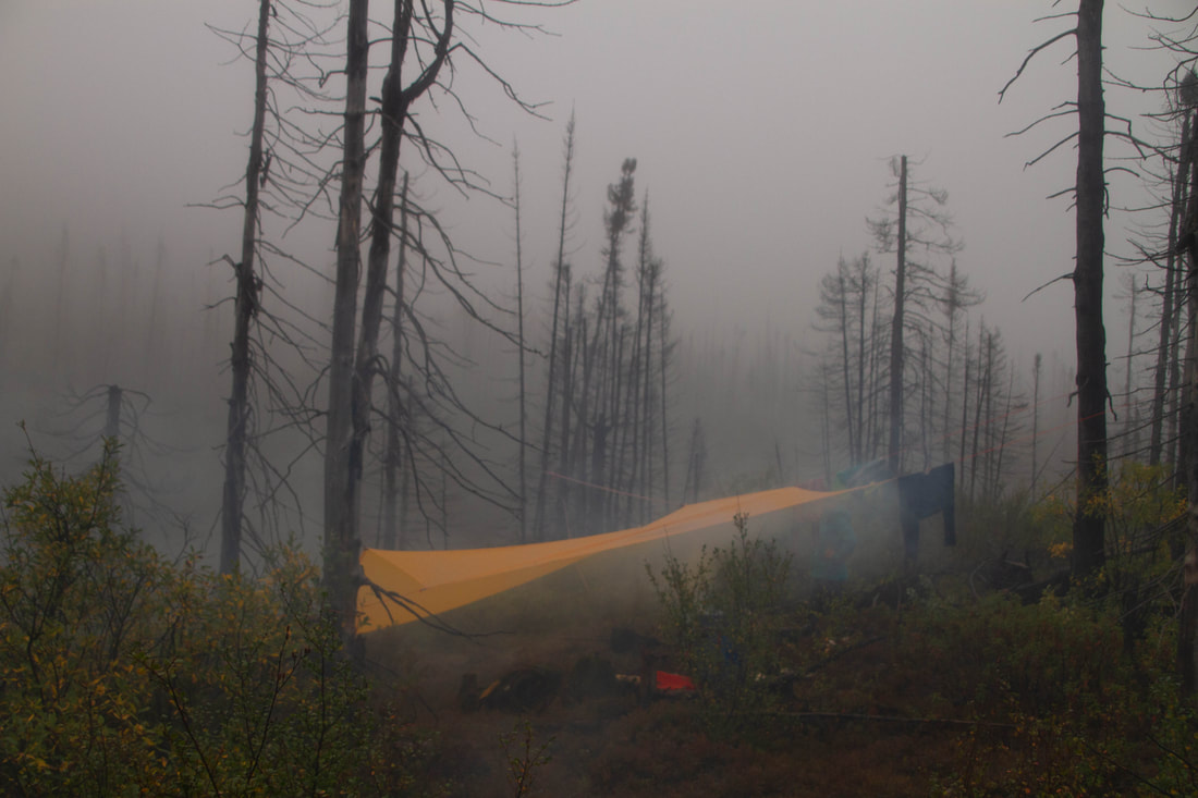
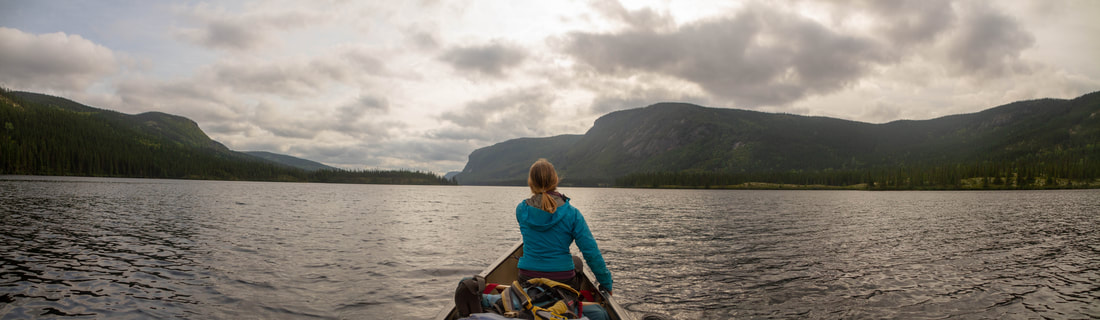
A misty morning
|
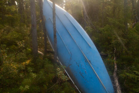
An old canoe
Lac Dufresne
Mountains rising in the distance. These framed both Lac Katchipitonkas and the river after the lake
|
Lac Kachipitonkas
A scenic portage
|
No water
|
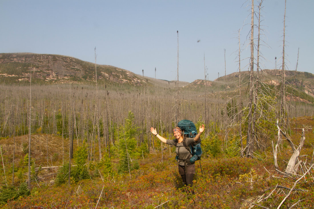
A spectacular hike
Another campsite
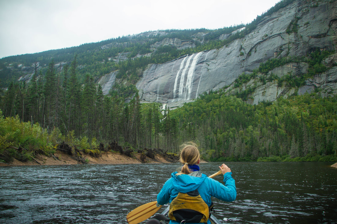
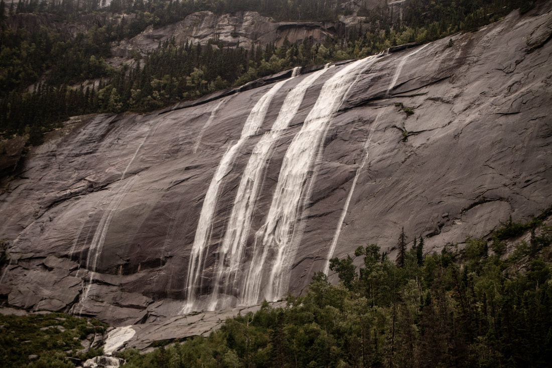
classic Nipissis waterfall
Cozy Nipissis bush camping
|
The first rapid of the railroad section of the Moisie. Normally there are rocks, and a huge rock island visible from this angle.
|
