General information
Number of participants: 8+2 guides
Number of days: 27 on river days. 2.5 days driving to get to the put in, 2 days to get back
Total Km: 275
Elevation drop: 1850 ft
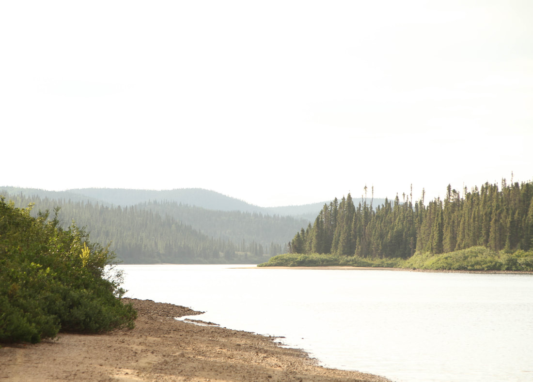
Water levels: Both the Pekans and Moisie where very low. This was frustrating on the Pekans but, helpful on the moisie
Gauge: http://www.cehq.gouv.qc.ca/Suivihydro/graphique.asp?NoStation=072301
Some useful information regarding levels:
Having done the Moisie 3 times and the railroad rapids 4 times I have some thoughts on levels.
150-350 cms is average summer flow. 150 is very low, 250 is medium and 350 is high 350-550 is very high! I think most people will not like the railroad rapids above 450 cms. I have kayaked the rail road section at 650 and it was very reminiscent of the Ottawa lunch stop waves at 10 on the gauge. I have also portaged the entire section (I was in canoe) at over 1100 cms.
General Weather: less wet then usual, it was after all a drought year
Overall pace of trip: relaxed
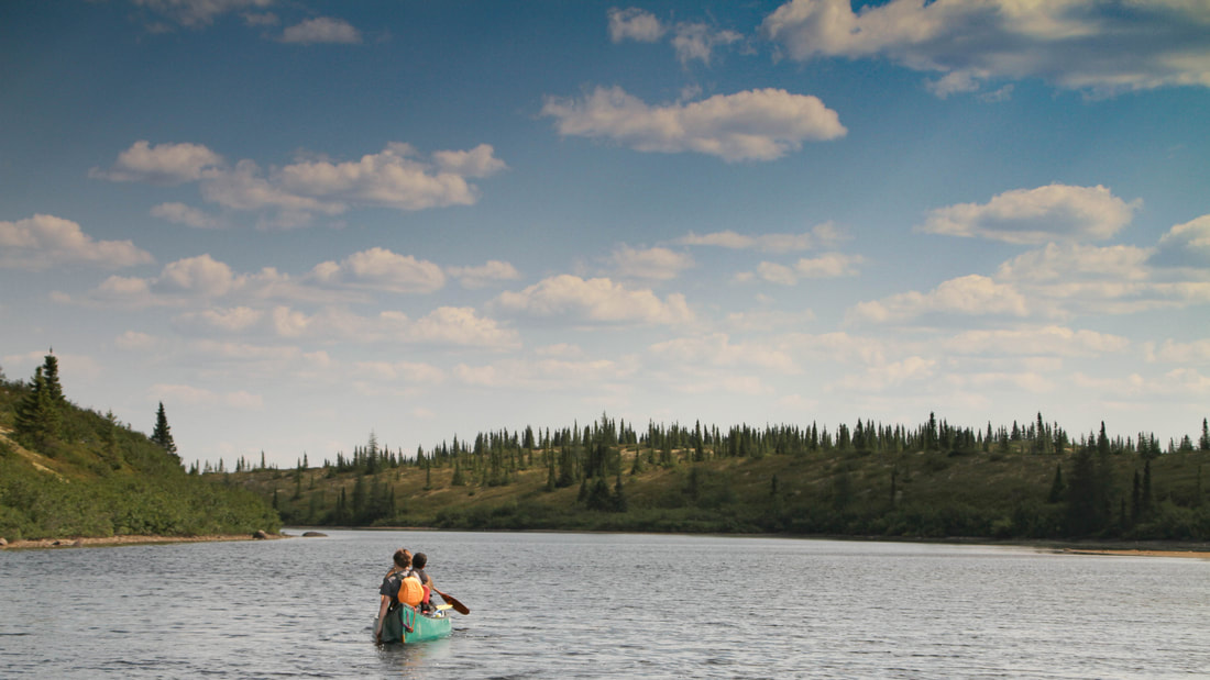
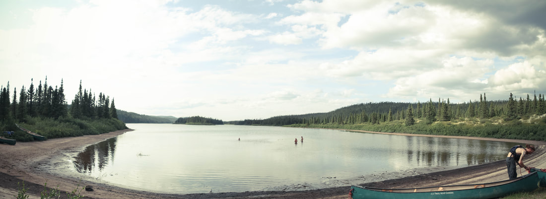
Camping Overview: Pekans river is mostly bush crashes on beautiful expanses of caribou lichen. There are a few established campsites scattered across the river. These are found generally around portages. The Moisie also has few established campsites and are generally found around portages. For the most part expect to camp on gravel beaches.
Portaging overview: Both the Pekans and Moisie have challenging portaging. Many of the portages are very steep and occasionally cliff like. Many of the take outs you can only load one boat at a time due to cliffs or steep embankments.
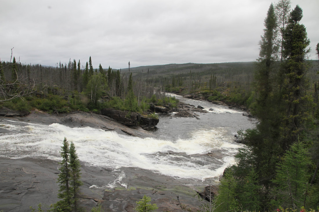
White water overview: The upper Pekans, with our water level needed more water. With more water there would be plenty of fun wave trains. It would have a creaky/big water feel. The Moisie is largely big water. With our levels there where plenty of ‘creaky’ moments, after the confluence of Riviere Taoti it becomes exclusively big water. The gorge rapid we paddled on Day 17 is indicative of all the other big rapids down stream, and it will only get bigger. Stay sharp on the train tracks section at the end. It is a lot of fun but, a lot can go wrong.
Number of participants: 8+2 guides
Number of days: 27 on river days. 2.5 days driving to get to the put in, 2 days to get back
Total Km: 275
Elevation drop: 1850 ft
Water levels: Both the Pekans and Moisie where very low. This was frustrating on the Pekans but, helpful on the moisie
Gauge: http://www.cehq.gouv.qc.ca/Suivihydro/graphique.asp?NoStation=072301
Some useful information regarding levels:
Having done the Moisie 3 times and the railroad rapids 4 times I have some thoughts on levels.
150-350 cms is average summer flow. 150 is very low, 250 is medium and 350 is high 350-550 is very high! I think most people will not like the railroad rapids above 450 cms. I have kayaked the rail road section at 650 and it was very reminiscent of the Ottawa lunch stop waves at 10 on the gauge. I have also portaged the entire section (I was in canoe) at over 1100 cms.
General Weather: less wet then usual, it was after all a drought year
Overall pace of trip: relaxed
Camping Overview: Pekans river is mostly bush crashes on beautiful expanses of caribou lichen. There are a few established campsites scattered across the river. These are found generally around portages. The Moisie also has few established campsites and are generally found around portages. For the most part expect to camp on gravel beaches.
Portaging overview: Both the Pekans and Moisie have challenging portaging. Many of the portages are very steep and occasionally cliff like. Many of the take outs you can only load one boat at a time due to cliffs or steep embankments.
White water overview: The upper Pekans, with our water level needed more water. With more water there would be plenty of fun wave trains. It would have a creaky/big water feel. The Moisie is largely big water. With our levels there where plenty of ‘creaky’ moments, after the confluence of Riviere Taoti it becomes exclusively big water. The gorge rapid we paddled on Day 17 is indicative of all the other big rapids down stream, and it will only get bigger. Stay sharp on the train tracks section at the end. It is a lot of fun but, a lot can go wrong.
Days 1-2
so many days driving!!!!!! We arrived around mid day on day 3.
Day 3
Campsite: 123 311 23 B/11
HOW: 2:30-4
Distance: 6km
Weather: Hot/sunny
Tech:
1) Water level is very, very, very low
Day 4
Campsite: 163 280
HOW: 8:30-4:30
Distance: 9km
Weather: Warm, annoying headwinds in afternoon
Tech:
1) R1 138 345
2) R1/2 142 342 – three channels: we took center (R1), RR an R2
3) R3 ledge 163 285 – portage RR, 100m. We ran RR sneak channel (R2) had wrap in R1 run out, took 1h:30 to unpin
4) R2 162 281 – lined RR
Day 5
Campsite: 263 136 23 B/6
HOW: 8:30-4:30
Distance: 15km
Weather: Hot, sunny, no wind
*Note: paddled for 30 min at washout of campsite rapid
Tech:
1) R1 163 279
2) R4 slide 172 268 – portage RL, 85m. Take out is at brink of falls
3) R1 RL after portage
4) R4 172 268 – portage RR, 100m. Take out is at brink, also a terrible put in at the end (very steep not great loading)
5) R1/swifts 142 241 for 1.5km
Day 6
Campsite: 338 003 (camped on portage)
HOW: 8:30-5
Distance: 16km
Weather: cool, rain, getting warmer in afternoon? Tailwinds
Tech:
1) R1 310 040
2) R1 315 033 leading into…
3) R4 316 034 – portage RR 200m. Many trails, easy to get lost
4) R3 ledge 322 023 – portage RR 100m. Then…
5) R1/2 for 300m directly after
6) R1 328 007 – RR of island
7) R3 ledge 338 003 – portage RL 200m. Camped here.
Day 7
Campsite: 443 842 23 B/2
HOW: 8:30-4 (finished portage/ on water at 9:30)
Distance: 20km
Weather: tailwind, cool
Tech:
1) R3 265 944 23 B/7 – Portage RL 300m
Day 8
Campsite: 486 848 23 B/2 start of Grand Chute portage
HOW: 8:30-4:45
Distance: 6km
Weather: constant cool drizzle
Tech:
1) R2 444 839 – ran right channel tight right
2) R4+ (5) 449 839 – portage 200m. From the start go left, nicer trail but not obvious. Right is obvious, but not as nice. Loading is one at a time down a cliff, classic.
3) R2/3 – right after portage. Ran inside of ben R2
4) R1 455 834 – the approach to the 900m portage. Ran RL between the two islands (457 834). Scraped our way RL till small eddy. Lined down to start of portage (at lip of R3/4 ledge)
5) 1 km of R4/5(+) – portage 900m RL. One boat unloading, no eddy (beached on rocks to unload). Trail is very bushy, swampy at start. At 463 828 there is a campsite, after this there is a good trail. We did it in two legs: first leg to the campsite, second to the end. It took us 1:45-2hrs.
6) R1 465 827
7) R2/3 ledge 464 829 – ran RR swift, ferried RL and lined
8) R3 473 828 – ran far RL (R2). *caution* beached RL around corner - ran tight RL (R1 ledge) to avoid R2/3 in center
9) R1 480 834
10) Grand Chute 486 848 – portage 1.5 km make shift site at start. Kitchen and tenting for 1-2 tents at takeout. More room 25m down the trail on left.
Day 9
Campsite: end of portage
HOP: 8:30-4
Weather: overcast and buggy
*Note: This is a very hard portage. We broke it up into three legs. The first, the longest and most challenging was very rocky, steep, and occasionally cliffy. It was also swampy and octionally difficult to follow because of the burn. The second half has a few very steep sections that would be dangerous if wet. There is also one cliff that we had to lower the equipment down. Have a happy portage.
Day 10
Rest day
Day 11
Campsite: 507 799 (end of last rapid)
HOW: 1:45 -3:45 (hours on hike: 8:30 -11
Distance: 6km
Weather: sunrainsunrainsunrain
*Note: 1) we went on a 2.5 hr hike to see the Grand Chute. Difficult hiking, mesmerizing view. 2) Moisie river level is very, very, very low
Tech:
1) R3/4 503 829 – portage RR 500m. With a more skilled group and better weather one might be able to line/ run the top and then possibly line RR of the bottom island next to the shore. Scout for your self.
2) R3 chute 505 806 RL of island – we lined due to water levels, other groups have lifted over RL
3) R3 507 799 – scout RL (portage is also RL, 200m) it is bigger than it looks from the top.
Day 12
Campsite: 515 756 *note: this area dose not have the greatest camping, but it works
HOW: 9:30-4:30 (paddled set at campsite from 9:30-11:30)
Distance: 4.5km
Weather: sun and clouds, warm?
Tech:
1) R3 507 794 – lined RR
2) R3/4 513 785 – Looked for portage RR, looked real shit. Non on RL. Ran tight RL of large square center rock. *note: possible camping RL at top, and on rocks at bottom RR, no promises.
3) Swift 515 775
4) R1 515 765 goes into….
5) R3 515 762 – ran tight RL, caught micro eddy RL. Lifted over around ledge
Day 13
Campsite: Chute Marmot 573 635
HOW: 9-3
Distance: 14km
Weather: rain in morning. Sun, rain in afternoon
Tech:
1) R2 515 756 – right after campsite, flows into R1
2) Swifts
3) R5 514 743 portage RL, 400m – steep + cliffy at start. Steep at end.
4) Swifts/ R1s for 8ish kms
5) Chute marmot 573 635 portage RR, 100m
Day 14
Campsite: 406 746 22 O/16
HOW: 9-5
Distance: 26km
Weather: overcast, becoming very sunny
Tech:
1) R3 576 627 22 O/15 – ran RL channel (R2). R1 to follow
2) R2/3 581 617 22 O/15 -500m long ran RR. Big finish.
3) All marked sets are R1s/ swifts
4) Uber fast current/ swifts for dayzz
Day 15
Campsite: 822 285 22 O/9 (end of the portage, upstream on beach)
HOW: 8:30-5:30 *note: we only brought essentials to end of the last portage.
Distance: 14km
Weather: blue bird, hot
Tech:
1) R2 733 383 22 O/16 – ran RL (R1) then….
2) R1 run out after previous
3) Swifts/ r1s for 5kms
4) R3 778 322 22 O/16 – ran RR (R1)
5) R2 778 315 – looks huge because of the rocks
6) R5 794 313 portage RL 450m – portage is almost at lip, camping in middle.
7) R3/4 798 307 – ran RR, R2 boulder garden with fun ledge at bottom around corner. Eddied out RR. *CAUTION* next we ferried RL because right bellow is….
8) R4 799 307 – lift over RL
9) R1 805 300 – stay left! Because….
10) R4 799 307 lift over RL
11) R1 812 294
12) R3/4 portage RL, 150m – possible camping at start?
13) R4/5 817 287 portage RL, 600m – not nice trail, multiple offshoots, steep up/ down. Due to time we brought essentials to end, camped upstream on beach.
Day 16
Campsite: 838 107 (was a campsite, now very bushy, lots of fallen trees. A real fixer upper. Cleared 3 tent spot
HOW: 8-2:30 (portaged 8-10, paddled to 2:30)
Distance: 18km
Weather: sunny morning, thunderstorm midday, cloudy afternoon, windstorm at night
Tech:
1) Nothing larger than an R1
Day 17
Campsite: 889 107 22 O/8 (gravel bar, cleared one tent site in bush)
HOW: 9-1:30
Distance: 7km
Weather: cool, cloudy, morning rain, afternoon sun/cloud
Tech:
1) R1s from site till….
2) R3 858 086 – big waves center. Eddy hopped RR, mostly R1/2, becoming R2 halfway down. Leads into….
3) R3/4 - ran RR. BIG! Pool at bottom, 1 swamp.
4) R2 around corner
5) Swifts till campsite
Day 18
Rest day
Day 19
Hike day
Hours on Hike: 10:15-3:45
Weather: hot/sunny
Tech:
Hiked RR of creek (left as you look at it) till approximately 887 067. Very beautiful.
Day 20
Campsite: 917 762 22 O/1 (gravel bar with kitchen and 1 tent in woods. You could possibly put 2 more tents in woods.
HOW: 8:20-3
Distance: 32 km
Weather: rain in the morning, overcast afternoon. Sun? More rain.
Tech:
1) R2 889 016
2) R3 875 000 – ran tight RR (R1)
3) Swifts for Dayzzz
Day 21
Campsite: 853 574 (gravel bar) *note we did not stay at the lodge RL because it looked like there where people there.
HOW: 8-4
Distance: 18km
Weather: hot, humid, headwinds
Tech:
1) Rapids Kachapahun (salmon ladder) portage RR 600m – RL portage seams to have fallen out of style and now no longer exists. RR is now maintained every year. We did it in two legs: the first is really, really, really super duper steep. 200ish m till the top. The second we went to the end. It also has a really, really steep down hill, it is steep, but short.
2) R3 891 626 – right after put. Ran RL of the house rock.
3) R1 run out
Day 22
Campsite:835 340 22 J/16
HOW: 8:30-3
Distance: 30km
Weather: morning drizzle, overcast/ headwinds in afternoon
Tech:
1) R2 857 556
2) R2+ 848 515 – ran tight right R1/2. Flows into….
3) R1 run out
4) Swifts/R1 till…
5) R2+ 842 228 – long rapid. Ran center driving right. Flows into….
6) R2 run out
7) Swifts/R1 till 805 420
Day 23
Campsite: 022 057 22 J/9 (end of portage, very nice beach)
HOW: 8:30-4
Distance: 38km
Weather: ridiculously hot, strong headwinds in afternoon
Tech:
1) Nothing greater than an R1
2) Current flows at 4kmhr
Day 24
Campsite: 992 798 (gravel bar, very protect on the back side)
HOW: 8-330
Distance: 32km
Weather: raining buckets all day
Tech:
1) R3 993 803 – huge waves RR. Ran RL side channel into eddy (R3).
Day 25
Rest day
Day 26
Campsite: 997 750 22 J/8 small gravel bar (usually underwater?)
HOW: 9-4
Distance: 5km
Weather: hot, sunny
*note: emergency camping at a cabin at approximately 994 792 (after R5) and another cabin at 992 771 (before upper trestle rapids)
Synopsis: this is a big day! After the R5 it is continuous R3/4 all the way to the end. A lot can go wrong today, take your time!
Tech:
1) R5 995 796 Portage/ lift over RL – huge boils in run out. *note: RR channel is also a no go.
2) R2 994 788 – boat scouted, big waves. Careful as it flows directly into continuous R3
3) R3 ran tight RR
4) R3 – ran RR, punched hole into eddy. Center waves are MASSIVE!
5) R4 793 776 Power line – ran three different lines tight RL, CdrivingR, tight RR. TRULY MASSIVE!
6) R3/4 991 767 Upper Trestle – ran tight RR (R2+)
7) R3/4 993 763 Lower Trestle – tight RR R2+
8) R2 995 763
9) R1 996 760
Day 27
Campsite: end of the river (trailer park)
HOW: 10-12:30
Distance: 12 km
Weather: hot, sun and cloud
*note: there is a chip truck at the time of this writing at the trailer park
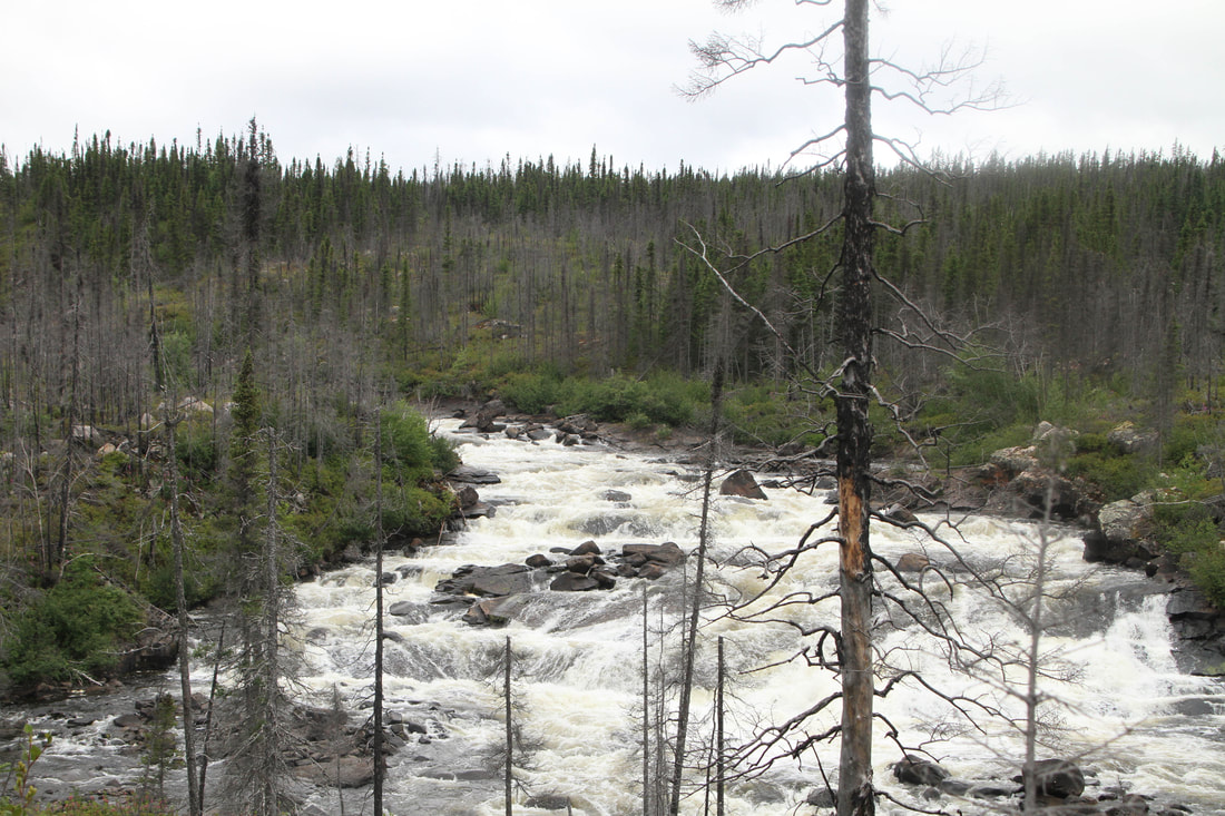
The little sticks of the Riviere Pecans
|
A hazy Pecans
|
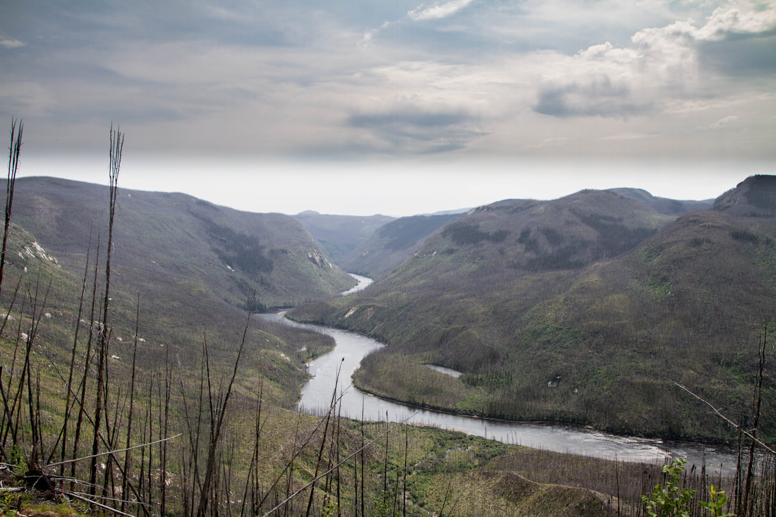
Just a portion of the Grand Chute of the Riviere Pecans
|
Some of it is runnable in kayak, but others are not. Best to make the portage like everyone else.
|
Classic canyon country in the Cote Nord
|
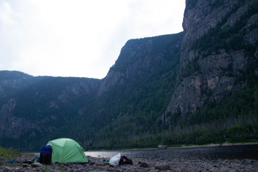
The Cote Nord never disappoints in terms of scenery
|
