Broadback River
General Information:
Maps required: 32 J/14, 32 J/11, 32 J/12, 32 J/13, 32 K/9, 32 K/16, 32 K/15, 32 N/3, 32 N/5, 32 M/8, 32 M/7
Trip reports used: Lester Kovac’s trip report (heavily used), Camp Wanapitei 2009, trip report (used often),Camp Wanapitei 2015 trip report (had high water levels so not used very often)
Emergency access points:
Total paddling distance: 576km
Days on trip: 26 – 2 rest days, 1 day on James bay
Number Portages: 13. Portages are usually flagged but some are mildly overgrown. Some are very difficult.
Total portaging distance: 5.9km
Elevation drop: 1.0 foot per km before James bay highway and 4.0 feet per km afterwards.
Pace of trip/ level of difficulty: average length days at the beginning and very relaxed at the end. With spray skirts and low water levels the trip was a lot easier than expected considering the difficulty of the whitewater on this river.
Skill level of group: very skilled paddlers and portagers.
Water levels: low
General weather: Very cold throughout. Rain at beginning and end but sun in the middle. Weather patterns in this area tend to hang around for a while. Very strong head winds throughout most of the trip as that is the direction of the prevailing winds.
Driving days: total 2.25 days – 1.25 days on the way up (approx. 12 hours if you don’t stop for the night) and 1 on the way back (approx. 10 hours with very quick stops)
Driving directions: Put in is at km 131 on Route du Nord on Lac Labeau. You pass over the Broadback river bridge and the put in is immediately on the left. There is a campground/rest stop on the right – do not need to pay. The put in is across the road from this rest stop and there is a 100m portage down to the river.
General recommendations for running this river:
Abbreviations/ Language for Tech:
Waskaganish information:
the best dock to unload at is just around the point at the eco lodge (it looks like a cabin!). Is a dock before that in front of the Northern but some locals said it was better to go to the next one. We camped just behind eco lodge on a property. $15 per tent. Eco lodge had great food and bathrooms. Locals are all very friendly and love chatting. Are also lots of cultural centers for tourists so ask at eco lodge desk. Spending a day in Waskaganish is recommended as there is so much history and culture to learn and the locals are very happy to share. Apparently are showers at rec center but we didn’t have time to find them or use them.
Day 1
Campsite: Petro Canada - on the drive – where highway 113 and 167 intersect. Approx. 20km from Chiougamau. Camped just behind the motel.
HOW: 0
Distance travelled: zero paddling distance
Weather: sunny all day then huge thunder storm at dinner time.
Synopsis: long drive – could have made it to the put in a 11 hour drive but barely and our driver wanted to stop at a motel to sleep so we stopped.
Day 2
Campsite: 32 J/11 - 798 189
HOW: 10-2:30 (4.5)
Hours on bus: 2 hours
Distance travelled: 12km
Weather: rainy and cold
Synopsis: no whitewater.. all lake paddling. Easy and great way to warm up those paddling muscles.
Day 3 – Start of whitewater
Campsite: 32 J/11 - 705 199 (cute island. Very small but lovely)
HOW: 11-5:30 (6.5)
Distance travelled: 11km
Weather: sunny
Synopsis: super fun! Easy boat scout. Really what you look for in canoeing a mix of tense moments and fun.
Tech:
Day 4
Campsite: 32 J/13 523 292 – on rock at top of long set. Camped in bush on moss. Bush crash but nice?
HOW: 10-5:30 (7.5 hours)
Distance travelled: 22km
Weather: very rainy
Synopsis: mainly long lakey paddling sections with some sets. A couple bigger ones but mostly R1’s/swifties that were VERY ROCKY. All safe with big pools and eddies.
Tech:
Day 5
Campsite: 32 J/12 298 188
HOW: 10:30-6:30 – 8 hours
Distance travelled: 24km
Weather: cloudy with rain
Synopsis: long fun technical rapids. High risk of wrapping boats – lots of rocks.
Tech:
Day 6 – Thou Shall Not Dry
Campsite: 32 K/16 – 071 228. Bush crash on super small island. Don’t recommend this.
HOW: 10:30-6 (7.5)
Distance travelled: 24km
Weather: windy (very) rainy and super cold.
Synopsis: lots of flat water and it was soooo cold, rainy and head winds. We were in low spirits and had super bad head winds so didn’t go as far as we wanted. Without headwinds you could easily make it to Quenonisca falls (camp just before the portage – no site at the end!)
Tech:
Day 7 – Better I Guess?
Campsite: 871 277 – 32 K/15. small on flat rock. Lovey kitchen but minimal tent sites.
HOW: 10-6 (8 hours)
Distance travelled: 24km
Weather: cloudy and occasional rain. Very slight winds
Synopsis: more lakes. Good portage on an ATV trail. Lack of wind was a big bonus.
Tech:
Day 8 – the trek on Bair du Corbeau
Campsite: 32 K/15 - 776 394. On beach - Tropical like.
HOW: 10-5 (7 hours)
Distance travelled: 23km
Weather: started sunny and warm then turned to rain and clouds. Minimal winds = great.
Synopsis: we made short work of Baie du Corbeau due to lack of headwinds. Minimal whitewater day.
Tech:
Day 9 – Lac Evans part 1
Campsite: 32 K/15 616 328 – beach at the top of long point.
HOW: 6am-4:30pm (10.5 hours)
Distance travelled: 20km
Weather: cloudy, sunny, windy and rainy
Synopsis: this is a big lake. We were very lucky with wind it could have been wayyyy worse.
Tech: paddling to 575 385, crossed to big island and breakfast at 745 393. Crossed to long point. During this crossing wind came up around 10am.
Day 10 – Lac Evans Continued and WAYY BETTER
Campsite: 32 K/15 703 510. beautiful flat rock on small island at end of lac Evans. Only island not burnt. Best campsite yet and flat! No firewood but 50m paddle away is a ton. Would recommend a rest day here!
HOW: 10:30 – 4:30 (6 hours)
Distance travelled: 18km
Weather: Sunny All day! A first for our trip! Also a small tail wind (also a first for the trip)
Synopsis: lovely day. The prevailing winds on this lake give you side winds and a bit of tail winds. Also the burnt forest starts at the end of the lake! Lovely blueberries but high bear risk potential.
Tech: none
Day 11 – Burnt forest, a bear, sweet side channel, and northern lights
Campsite: 728 607 – choose your own adventure bush crash but super scenic in burnt forest.
HOW: 10-5 - 7 hours (but we were very slow today)
Distance travelled: 15km
Weather: sunny
Synopsis:
Day 12 – Lac Gifford and a long portage
Campsite: 639 748. Established on island. Super big and flat. Entrance is in bushes but was flagged.
HOW: 9:30-6 (8.5 hours)
Distance travelled: 16km
Weather: sunny
Tech:
Day 13 – The Melon and Blueberry pie!
Campsite: 405 737 32 N/3 - nice bush crash. Is a beach campsite right beside this but the quebecois couple camped there.
HOW: 10-6 (8 hours)
Distance travelled: 26km
Weather: sunny and huge headwinds
Synopsis: soooo much wind! This would be soo easy without wind as there is lots of current and swifts. We recommend leaving early to avoid wind cause its straight and flat.
Tech:
Day 14 – Across the James Bay Highway!
Campsite: gorgeous rock dome. Established.
HOW: 7:30am – 4pm (9 hours)
Distance travelled: 20km
Weather: sunny and no wind
Synopsis: great whitewater with lots of rocks and the portage across James Bay highway takes a lot of time.
Tech:
Day 15 – the calm before the storm and the push to rest day site
Campsite: Rooster falls – words cannot describe the energy here.
HOW: 9:30-6:30 (9 hours)
Distance travelled: 26km
Weather: sunny and COLD and headwinds
Synopsis: today is a long day. It is windy so it is wayy longer. the whitewater easy
Tech:
Day 16 – REST AND RELAXATION
Campsite: rooster falls
HOW: 0
Distance travelled: 0
Weather: sunny and also hot wohoo
Synopsis: if running rooster falls: run center over the rooster tail. 1. Turn backwards. 2. Take seflie 3. Place head between legs and kiss your butt goodbye
Day 17 – As we drop off the face of the earth we realize we drop fast
Campsite: The DAB 952 741 - 32 N/4
HOW: 6 hours (9-3)
Distance travelled: 4km
Weather: sunny – no wind
Synopsis: the rapids after rooster falls are basically continuous until the dab. We blasted through the whitewater fast because we had spray skirts and could boat scout because of the low water levels. If we didn’t have these scouting on shore would have made it long. Portages were through burnt and flagged.
Tech:
Day 18 – THE 100 foot waterfall
Campsite: the big waterfall
HOW: 10-4:30 (6.5 hours)
Distance travelled: 8km
Weather: cloudy
Synopsis: OMG the falls are big! The day is all good though.
Tech:
Day 19 – REST, HIKE, WATERFALLS and RAFTS
Campsite: 100 foot waterfall
HOW: 0
Distance travelled: 0 – although we did hike 1.5km up the other side of the falls.
Weather: rainy
Synopsis: we didn’t plan for this rest day but we were running whitewater so much faster than the trip report we were following. Our lower water levels, smaller group and spray skirts made us go wayyy faster.
Day 20 – sweet big whitewater
Campsite: 962 843 32 M/8 - on flat rock, super nice tons of tent sites.
HOW: 10-4:30 (6.5h)
Distance travelled: 12km
Weather: sunny (and wind for flatwater section)
Synopsis: whitewater was continuous R2/R3 after the falls. Spray skirts were necessary and tons of back paddling. Lakey section was unpleasant due to headwinds.
Tech:
Day 21 – Boat Scout
Campsite: 836 830 (32 M/8)
HOW: 10-3 (5 hours)
Distance travelled: 13km
Weather: sun and headwinds
Synopsis: its all good. The last set of the day is a big one. Stayed right all day and it was very relaxed. Other groups found it more stressful without spray skirts.
Tech:
Day 22 – Soooo glad we have spray skirts
Campsite: 836830 - on a small flat rock
HOW: 10-3:30 (5.5 hours with extended lunch)
Distance travelled: 15km
Weather: rainy all day – no wind but cold
Synopsis: we loved the whitewater! Sometimes leader stressful but had no dumps. Again spay skirts allowed us to boat scout saving us tons of time. Also super competent paddlers as we ran our biggest set of the trip today and would have swamped multiple times.
Tech:
Day 23 – OF HORRIBLE ARTCIC HEADWINDS and BOATS
Campsite: 504 907 32 M/7 – on island
HOW: 10-6:30 (8.5 hours)
Distance travelled: 15km
Weather: rain and headwinds
Synopsis: could have completed this much faster if there was no wind. Whitewater was easy and we filled a barrel with water at the end of the last set.
Tech:
Day 24 – The Loooooong Bay Day
Campsite: Waskaganish Misson
HOW: 4am – 4pm (12 hours)
Distance travelled: 23km
Weather: sooooo windy and cloudy
Synopsis: we got up just before high tide and early in the morning so we could avoid wind. The wind from the previous day blew all night but was manageable until we got to the point at 5:30am. We then battled crazy winds and tried to drag around the point but the water was deep (since it was high tide) and were no mud flats. By around 6:30am we made it to where some mud flats started and we could drag consistently. We dragged all the rest of the way into Waskaganish but were able to paddle the last 1km as we approached the channel and Ruptert river. We dragged at approx. 3km per hour but by the end of the day our pace had slowed to 2km/ hour as the mud flats were very hard to walk in.
Waskaganish information:
the best dock to unload at is just around the point at the eco lodge (it looks like a cabin!). Is a dock before that in front of the Northern but some locals said it was better to go to the next one. We camped just behind eco lodge on a property. $15 per tent. Eco lodge had great food and bathrooms. Locals are all very friendly and love chatting. Are also lots of cultural centers for tourists so ask at eco lodge desk. Spending a day in Waskaganish is recommended as there is so much history and culture to learn and the locals are very happy to share. Apparently are showers at rec center but we didn’t have time to find them or use them.
Maps required: 32 J/14, 32 J/11, 32 J/12, 32 J/13, 32 K/9, 32 K/16, 32 K/15, 32 N/3, 32 N/5, 32 M/8, 32 M/7
Trip reports used: Lester Kovac’s trip report (heavily used), Camp Wanapitei 2009, trip report (used often),Camp Wanapitei 2015 trip report (had high water levels so not used very often)
Emergency access points:
- Route du Nord bridge (put in) 250 388 - 32 J/14
- Logging road 499 229 - 32 J/13
- James bay highway 277 720 32 N/3
- James bay by boat
Total paddling distance: 576km
Days on trip: 26 – 2 rest days, 1 day on James bay
Number Portages: 13. Portages are usually flagged but some are mildly overgrown. Some are very difficult.
Total portaging distance: 5.9km
Elevation drop: 1.0 foot per km before James bay highway and 4.0 feet per km afterwards.
Pace of trip/ level of difficulty: average length days at the beginning and very relaxed at the end. With spray skirts and low water levels the trip was a lot easier than expected considering the difficulty of the whitewater on this river.
Skill level of group: very skilled paddlers and portagers.
Water levels: low
General weather: Very cold throughout. Rain at beginning and end but sun in the middle. Weather patterns in this area tend to hang around for a while. Very strong head winds throughout most of the trip as that is the direction of the prevailing winds.
Driving days: total 2.25 days – 1.25 days on the way up (approx. 12 hours if you don’t stop for the night) and 1 on the way back (approx. 10 hours with very quick stops)
Driving directions: Put in is at km 131 on Route du Nord on Lac Labeau. You pass over the Broadback river bridge and the put in is immediately on the left. There is a campground/rest stop on the right – do not need to pay. The put in is across the road from this rest stop and there is a 100m portage down to the river.
General recommendations for running this river:
- Spray skirts are a must – after the James Bay highway the whitewater is very continuous and very big. Almost all sets could easily swamp an open canoe.
- Rivers goes into some 10-year-old burnt forest so be careful of bears on campsites. They love the blueberries and we saw tons of fresh bear scat.
- Campsites: lots of beaches and many established especially after the James Bay highway. Bring a fire box and practice no trace camping.
- The bigger whitewater is generally in the middle of the rapid but if you skirt down the shore or down side channels this makes it much more manageable. Scout and plan your route carefully as you often get committed to one side of the river once you start a set.
- Rupert’s bay – was very challenging for us with winds. We recommend getting up very early to make it to where the mud flats start (you can see it on the topographical maps) so if you become wind bound you can walk all the way along the mud flats to Waskaganish.
- Walkie-talkies are very important as you require communication throughout and there are few eddies in the whitewater section after the James Bay highway.
Abbreviations/ Language for Tech:
- DS – ducky style
- RR – river right
- RL – river left
- RC – river center
- 1BY1 – one by one
- Probe – leader boat goes down first then campers follow with 2nd leader boat leading them.
- Poop shoot: a small side channel usually very narrow and straight. Helpful way to avoid going down massive rapids.
Waskaganish information:
the best dock to unload at is just around the point at the eco lodge (it looks like a cabin!). Is a dock before that in front of the Northern but some locals said it was better to go to the next one. We camped just behind eco lodge on a property. $15 per tent. Eco lodge had great food and bathrooms. Locals are all very friendly and love chatting. Are also lots of cultural centers for tourists so ask at eco lodge desk. Spending a day in Waskaganish is recommended as there is so much history and culture to learn and the locals are very happy to share. Apparently are showers at rec center but we didn’t have time to find them or use them.
Day 1
Campsite: Petro Canada - on the drive – where highway 113 and 167 intersect. Approx. 20km from Chiougamau. Camped just behind the motel.
HOW: 0
Distance travelled: zero paddling distance
Weather: sunny all day then huge thunder storm at dinner time.
Synopsis: long drive – could have made it to the put in a 11 hour drive but barely and our driver wanted to stop at a motel to sleep so we stopped.
Day 2
Campsite: 32 J/11 - 798 189
HOW: 10-2:30 (4.5)
Hours on bus: 2 hours
Distance travelled: 12km
Weather: rainy and cold
Synopsis: no whitewater.. all lake paddling. Easy and great way to warm up those paddling muscles.
Day 3 – Start of whitewater
Campsite: 32 J/11 - 705 199 (cute island. Very small but lovely)
HOW: 11-5:30 (6.5)
Distance travelled: 11km
Weather: sunny
Synopsis: super fun! Easy boat scout. Really what you look for in canoeing a mix of tense moments and fun.
Tech:
- 788 184 – swift
- 785 184 – R2. DS. RR
- 774 197 – RR channel. R2 ledge at bottom.
- 764 192 – top section: RL of island. R1 lined/dragged to large bay RL. Did not scout RR channel. Middle section: lined RL ledge (R2) – ran 1BY1 to RR island (R2) and ran the outwash. Lots of rocks and holes and small rock islands.
Day 4
Campsite: 32 J/13 523 292 – on rock at top of long set. Camped in bush on moss. Bush crash but nice?
HOW: 10-5:30 (7.5 hours)
Distance travelled: 22km
Weather: very rainy
Synopsis: mainly long lakey paddling sections with some sets. A couple bigger ones but mostly R1’s/swifties that were VERY ROCKY. All safe with big pools and eddies.
Tech:
- 697 201 – ran right channel. Swifty followed by R2 tech – we scouted the top then ran ducky avoiding rocks and pillows.
- 684 187 – R1 ducky
- 658 182 – power lines set. R2 ran RL 1BY1. Super fun and big waves… some back paddling. Scout from island.
- 646 180 – swifty/ R1
- 639 181 – swifty/R1
- 628 180 – swifty/R1
- 583 206 – R1 with rocks
- 581 205 – ran right channel. very rocky R1 ran RR of island (RL was dry). We may have been better to go with the right channel around the large island as our water levels were low.
Day 5
Campsite: 32 J/12 298 188
HOW: 10:30-6:30 – 8 hours
Distance travelled: 24km
Weather: cloudy with rain
Synopsis: long fun technical rapids. High risk of wrapping boats – lots of rocks.
Tech:
- 32 J/13 – 525 222 – R1. DS
- 32 J/16 – 516 226 – R1. DS – big waves
- 516 228 – R1. DS. Left of island
- 514 224 – R1/R2. Long. Boat scouted
- 504 229 – the island! Scouted from RL channel on island. Ran RR channel (R1) eddy at bottom on island. Ran bottom to bridge. Bottom is an R3. 1BY1 on RL.
- 490 to 466 221 (32 J/13) – R1’s / swifts
- 433 217 (32 J/12) R1 – DS
- 403 220 – R3 right channel ran truck and trailer. Boat scouted. Lots of rocks and fun!
- 399 217 to 390 217 – long R1s boat scouted.
- 349 197 to 344 193 – scout top section from island. Ran R2 to RR eddy. Lifted over RR around R4 chute. Very scenic in a pinch could camp in area but would be bad. Ran bottom R2 truck and trailer.
Day 6 – Thou Shall Not Dry
Campsite: 32 K/16 – 071 228. Bush crash on super small island. Don’t recommend this.
HOW: 10:30-6 (7.5)
Distance travelled: 24km
Weather: windy (very) rainy and super cold.
Synopsis: lots of flat water and it was soooo cold, rainy and head winds. We were in low spirits and had super bad head winds so didn’t go as far as we wanted. Without headwinds you could easily make it to Quenonisca falls (camp just before the portage – no site at the end!)
Tech:
- Swifties just after campsite
- 32 K/9 - 249 191 – R2 ran left channel. Ran center then left close to island.
- 140 218 – swifties.
Day 7 – Better I Guess?
Campsite: 871 277 – 32 K/15. small on flat rock. Lovey kitchen but minimal tent sites.
HOW: 10-6 (8 hours)
Distance travelled: 24km
Weather: cloudy and occasional rain. Very slight winds
Synopsis: more lakes. Good portage on an ATV trail. Lack of wind was a big bonus.
Tech:
- Portage: 32 k/16 216 226 – On left shore. Quality portage. 250m
- 975 275 – R1 DS
- 975 278 – R1 DS
- 931 282 (32 K/15) – R1 DS
- 915 275 – R1. DS.
Day 8 – the trek on Bair du Corbeau
Campsite: 32 K/15 - 776 394. On beach - Tropical like.
HOW: 10-5 (7 hours)
Distance travelled: 23km
Weather: started sunny and warm then turned to rain and clouds. Minimal winds = great.
Synopsis: we made short work of Baie du Corbeau due to lack of headwinds. Minimal whitewater day.
Tech:
- 869 284- R2 wave train. Big waves but scouted from boats and ran ducky.
- R1s just before the portage/falls. 1st at 788 281 ran RR and 2nd at 786 285.
- R4 ledge – 777289 – we ran a sneak route RR then lined a section then ran the bottom tight RR. We tried to find the portage on RR but couldn’t (apparently it exists?). We didn’t check the left but there is also apparently a portage and it may be runnable on the left?
Day 9 – Lac Evans part 1
Campsite: 32 K/15 616 328 – beach at the top of long point.
HOW: 6am-4:30pm (10.5 hours)
Distance travelled: 20km
Weather: cloudy, sunny, windy and rainy
Synopsis: this is a big lake. We were very lucky with wind it could have been wayyyy worse.
Tech: paddling to 575 385, crossed to big island and breakfast at 745 393. Crossed to long point. During this crossing wind came up around 10am.
Day 10 – Lac Evans Continued and WAYY BETTER
Campsite: 32 K/15 703 510. beautiful flat rock on small island at end of lac Evans. Only island not burnt. Best campsite yet and flat! No firewood but 50m paddle away is a ton. Would recommend a rest day here!
HOW: 10:30 – 4:30 (6 hours)
Distance travelled: 18km
Weather: Sunny All day! A first for our trip! Also a small tail wind (also a first for the trip)
Synopsis: lovely day. The prevailing winds on this lake give you side winds and a bit of tail winds. Also the burnt forest starts at the end of the lake! Lovely blueberries but high bear risk potential.
Tech: none
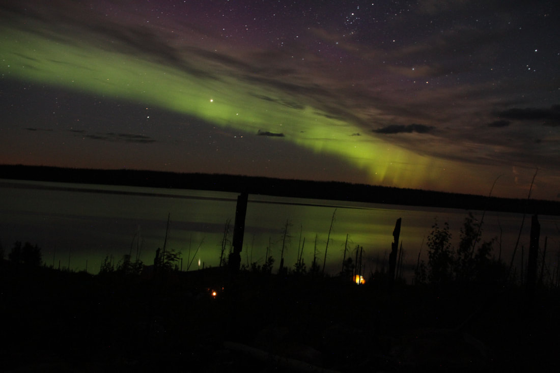
Day 11 – Burnt forest, a bear, sweet side channel, and northern lights
Campsite: 728 607 – choose your own adventure bush crash but super scenic in burnt forest.
HOW: 10-5 - 7 hours (but we were very slow today)
Distance travelled: 15km
Weather: sunny
Synopsis:
- NEWS: met a Quebecois canoeist couple who did the portage across long point. They said it took them 5 hours and it was hard. There is a trail but take the one to the right of the creek coming in. we took 16 hours total to paddle and we had good wind and very good conditions. Portage may be a better option? You are also getting sick of flat water paddling at this point.
- For the whitewater: it is possible to the R2 in the center and run hard RR on the R4 next to the island. Only scouted this but did not run
- 745 567 – ran far RR easy R1
- 745 570 – ran R2 RR of large island down a side channel. Huge waves and super fun narrow rapid that you go down super fast and straight.
- 752 578 – portage 250m RL around Burnt Hip falls in the burnt forest. Easy trail and super scenic portage. Take pictures! Falls are also gorgeous
Day 12 – Lac Gifford and a long portage
Campsite: 639 748. Established on island. Super big and flat. Entrance is in bushes but was flagged.
HOW: 9:30-6 (8.5 hours)
Distance travelled: 16km
Weather: sunny
Tech:
- paddle Lac Gifford – be careful of head winds. Ours were okay so we made good time
- portage 1.3km – 634 737. start is in the back of a marshy bay on the RL shore. We had to drag boats through a creek to get to the start. Great trail through sphagnum moss. Did it in 1 hour 25mins. Wide trail. Both 2007 and 2015 trip reports portaged but Lester Kovac lined the rapids. We scouted the rapids. There is an R4 then R5 and then an R2 at the bottom. We scouted the R4 and R5. R4 is definitely line-able on RL. R5 would be a hard line but there is also a semi established portage on RL just around that section. All in all we decided lining would take longer than portaging so we portaged. However for 1 or 2 boats lining would likely be faster.
Day 13 – The Melon and Blueberry pie!
Campsite: 405 737 32 N/3 - nice bush crash. Is a beach campsite right beside this but the quebecois couple camped there.
HOW: 10-6 (8 hours)
Distance travelled: 26km
Weather: sunny and huge headwinds
Synopsis: soooo much wind! This would be soo easy without wind as there is lots of current and swifts. We recommend leaving early to avoid wind cause its straight and flat.
Tech:
- 605 782 R3/R4 – lined to eddy RR and lifted over. Then ran R2 at bottom ducky.
Day 14 – Across the James Bay Highway!
Campsite: gorgeous rock dome. Established.
HOW: 7:30am – 4pm (9 hours)
Distance travelled: 20km
Weather: sunny and no wind
Synopsis: great whitewater with lots of rocks and the portage across James Bay highway takes a lot of time.
Tech:
- 334 727 R1 – DS
- 332 727 R1 - DS. RR eddy hopping to avoid bigger stuff in middle
- 33 719 R3/R4 – ran top to a small eddy on RR (tight!) then lined a rocky section then ran bottom section also tight right. With a little higher water levels there would be a cool sneak route RR!
- 299 727 to 301 731 – R2 pcik and choose RR. Waves. Noth crazy. Ducky
- 293 739 – R1 center/RL ducky.
- Portage 1.2km – we unloaded at 1st take out (about 300m above set) on RR. This takes you through a hunting cabin property where you go right along the driveway. Then take a left down the James bay highway for 700m. beware of lots of cars and trucks. Then go into the rest area and follow signs for the lookout which takes you to the river. There are tons of smaller trails that branch off of this so we flag. We did the portage in 3 stints: hunting cabin trail, James bay highway, rest area trail. Took 1 hour 25mins to portage but I scouted all the trails and different take outs for 45mins before this. Is a 2nd take out (further down river with boat) and a 3rd take out right before the falls. Bad trails and tons of smaller trails branching off so we decided not to do it. Emma and ET trip reports says they did a 500m trail. Also there are outhouses and can dump garbage!
- 275 731 – R2 pick and choose for 1.5km after highway. We didn’t need to eddy hop and ran ducky.
Day 15 – the calm before the storm and the push to rest day site
Campsite: Rooster falls – words cannot describe the energy here.
HOW: 9:30-6:30 (9 hours)
Distance travelled: 26km
Weather: sunny and COLD and headwinds
Synopsis: today is a long day. It is windy so it is wayy longer. the whitewater easy
Tech:
- 32 N/4 143 696 – R2. RL. Big waves eddy hopped for fun. Bottom is R1/RL
- 120 692 – R1. Easy
- 050 677 – R2 on RL and R1 on RR. Ran RR to RL.
- Bottom R1 center
- Portage 50m 023 076 – RR. 50m on dry creek bed to good fishing lake. Take out is flagged. Super sketchy rocks. High fall risk and ankle sprains
- Portage 400m – after 100m on good fishing lake along the RL shore. It is right after the rocky point in first bay. Take out is flagged. There is a trail through burnt stuff then into a forest. ** Kovac says you can line the rapid that portages #5 and #6 go around on RL if you have lots of time feel free to scout but you need to pull out 1km upstream on RL because it starts off in a canyon. It looks really big from downstream.
- 005 719 – R1 swift
- rooster falls take out is RR on rock slab right above falls. Approach with caution on right.
Day 16 – REST AND RELAXATION
Campsite: rooster falls
HOW: 0
Distance travelled: 0
Weather: sunny and also hot wohoo
Synopsis: if running rooster falls: run center over the rooster tail. 1. Turn backwards. 2. Take seflie 3. Place head between legs and kiss your butt goodbye
Day 17 – As we drop off the face of the earth we realize we drop fast
Campsite: The DAB 952 741 - 32 N/4
HOW: 6 hours (9-3)
Distance travelled: 4km
Weather: sunny – no wind
Synopsis: the rapids after rooster falls are basically continuous until the dab. We blasted through the whitewater fast because we had spray skirts and could boat scout because of the low water levels. If we didn’t have these scouting on shore would have made it long. Portages were through burnt and flagged.
Tech:
- Rooster falls portage – 600m. 982 722. trail is great. 3 put in’s.. 1st is into an R2. 2nd is on shallow rock but 3rd is in a shallow eddy just past the rock bed. We recommend the 3rd put in. we finished this super fast with breakfast in-between loads.
- 975 720 – R2 ran ducky on RR. Big waves. Lead boat scouted then the rest went ducky. We eddy hopped and Found portage trail at top of R4 in one of those eddies – apparently there is also a take out higher up.
- Portage 500m – RR. Take out in aforementioned eddy. Trail flagged in burn with the occasional death rocks (super round large rocks you twist your ankles in). not awful portage. Lining would be a challenge.
- 967 728 – ferried RL. Ran ducky (with lead boat scouting. We refer to this as probing) down through eddies. Is basically a continuous R2 with very big waves.
- 955 736 – ran/ dragged a side channel that was super narrow and had lots of rocks. We bumped and grinded and dragged. Eddy directly below island has the portage around the next set in it. RL
- Portage 350m to campsite – take out in aforementioned eddy and put in is at the end of the rapid. Trail is flagged and goes through burnt forest and death rocks again.
Day 18 – THE 100 foot waterfall
Campsite: the big waterfall
HOW: 10-4:30 (6.5 hours)
Distance travelled: 8km
Weather: cloudy
Synopsis: OMG the falls are big! The day is all good though.
Tech:
- R1s and swifts to rapides kawisi…….
- Rapides kawisis……947 752 – R1 around corner to large eddy. Lined to second eddy.
- Portage 100m from second eddy around R4. The R4 is rapides kawisi…
- 947 752 – R2
- 914 777 – R2. RR big waves
- 910 781 - lined RR down poop shoot (cool side channel) easy and fun!
- 912 788 – portage 350m. R4. Take out is in second eddy RR. Portage goes along rocks before going up and over a hill. Very steep at the end (cliff like)
- 914 796 – R1
- 919 799 – R1
- 920 815 – portage 100foot waterfall. Portaged 200m on dry creek bed on RR before the regular take out since right above the 100foot waterfall there is an R1 that leads directly into the falls. is easy but is it worth it? We say no and opted for safety. Also you don’t hear the falls till you portage around them. They are silent but deadly unlike Fraser’s farts.
Day 19 – REST, HIKE, WATERFALLS and RAFTS
Campsite: 100 foot waterfall
HOW: 0
Distance travelled: 0 – although we did hike 1.5km up the other side of the falls.
Weather: rainy
Synopsis: we didn’t plan for this rest day but we were running whitewater so much faster than the trip report we were following. Our lower water levels, smaller group and spray skirts made us go wayyy faster.
Day 20 – sweet big whitewater
Campsite: 962 843 32 M/8 - on flat rock, super nice tons of tent sites.
HOW: 10-4:30 (6.5h)
Distance travelled: 12km
Weather: sunny (and wind for flatwater section)
Synopsis: whitewater was continuous R2/R3 after the falls. Spray skirts were necessary and tons of back paddling. Lakey section was unpleasant due to headwinds.
Tech:
- Finished portage around falls by 10am – we portaged boats and unneeded gear the day before. Portage goes through campsite then down some massive steps, through a forest, across an open hill, down another massive step and through a forest to a rocky put in. 500m.
- 915 824 (32 N/5) – R1 RR – ducky to eddy
- 914 824 to 910 825 – start of a continuous R2/R3 section with not very many eddies. Ran RR with lead boat first probing. In the middle of this there are some exposed rocks on RR that are directly around a blind corner so you need to go very tight RR. Huge waves all the way down. Most other groups scouted from shore – spray skirts made this not necessary for us. We loved this rapid – 2nd favourite of trip -named Submarine on Kovac’s map. Is a 400m section of current before next big section. We ferried across to the other side here because of what is described below.
- 086 817 (32 M/8) – R2 avoiding pillows. Is a portage on RR but with our low water levels we were able to ferry across to RL just above this rapid. If you run RR you do need to portage but the left is runnable which is what we did!
- 12 km of flat-water – blehh
- 973 838 – R1. DS. Center big waves
- 966 836 – portage 200m RR through forest. Is an old cree trail. Is also a 100m portage on RR along a creek bed further down but we decided to save our ankles and go through the forest.
- Camped RL at start of R2 at 961 845.
Day 21 – Boat Scout
Campsite: 836 830 (32 M/8)
HOW: 10-3 (5 hours)
Distance travelled: 13km
Weather: sun and headwinds
Synopsis: its all good. The last set of the day is a big one. Stayed right all day and it was very relaxed. Other groups found it more stressful without spray skirts.
Tech:
- ran a R2 wave train train beside campsite. Then lined R4 below campiste – RL easy line and ran R2 at bottom
- 953 847 – R2/R3. Scouted RL didn’t need to. Its just waves. There are great poop shoots RL for higher water.
- 943 847 – R3 ran RR of island (R1) then stayed next to large island and ran R1 chute to rain flow. R2 at bottom. ***It may be possible to run tight RR of large island. We didn’t but it looks okay.
- 966 841 – R2/R3 ran RR eddy hopping
- 894 844 – top section was an R1 we ran RR then lined to R4 (easy line) and lined the R4. Lower section R2 shot RR of island then back to center.
- R1’s and swifties till next major section. Pick and choose
- 850 833 – R3 far RR all the way down. Small start and a BIG finish. Big waves and lots of pillows. Hope you have good paddlers other groups had swamps and dumps on this set. ferried to campsite RL on exposed rock.
Day 22 – Soooo glad we have spray skirts
Campsite: 836830 - on a small flat rock
HOW: 10-3:30 (5.5 hours with extended lunch)
Distance travelled: 15km
Weather: rainy all day – no wind but cold
Synopsis: we loved the whitewater! Sometimes leader stressful but had no dumps. Again spay skirts allowed us to boat scout saving us tons of time. Also super competent paddlers as we ran our biggest set of the trip today and would have swamped multiple times.
Tech:
- 835 829 – directly after/beside campsite is a long continuous R2/R3 for 2km that ends in an R3+ ledge. We started RR (other groups went RL then had to portage) and eddy hopped all the way down. At the very end (approx. 834 829) is where it is biggest with a ledge and hole which we ran with two leaders at the bottom as safety and northern rescue set up. We advise scouting this. Biggest set we ran all trip!
- Swifties and R1’s continue until the island set at 735 850. All pick and choose ducky
- 735 850 – island set. Starts with large rock island in middle. Huge ledge on RL and R3/R4 on RR. Then a massive R2 rock garden below island with a ledge section at the bottom. We rammed boats onto the island.. current wasn’t too strong for us but do be careful as you don’t want to go down either side. We then lifted over island 50m. then ran the rock garden below starting center moving left and avoiding rocks (right side had larger waves and likely a larger ledge at bottom). There are very few eddies RL (but we found 1 and used massive exposed rocks as eddies). Then shot a small rocky ledge RL and eddied out below on RL. Ran the outwash. R2 is rock city and also large waves.
- Swifties/ R1’s to campsite – continuous current. In higher water some are R2’s we think.
Day 23 – OF HORRIBLE ARTCIC HEADWINDS and BOATS
Campsite: 504 907 32 M/7 – on island
HOW: 10-6:30 (8.5 hours)
Distance travelled: 15km
Weather: rain and headwinds
Synopsis: could have completed this much faster if there was no wind. Whitewater was easy and we filled a barrel with water at the end of the last set.
Tech:
- 681 871 – R1/R2 we went RL of island but should have gone RR – was super shallow. Boney waves on RL looked better from the bottom.
- 12km of straight flat water – ughhh
- last set: 513 891 – R1/R2 on RR.
- 506 903 – also part of last set. R3 lifted over RR then dragged down shore. We maybe could have ran it but didn’t because we were sooo tired.
Day 24 – The Loooooong Bay Day
Campsite: Waskaganish Misson
HOW: 4am – 4pm (12 hours)
Distance travelled: 23km
Weather: sooooo windy and cloudy
Synopsis: we got up just before high tide and early in the morning so we could avoid wind. The wind from the previous day blew all night but was manageable until we got to the point at 5:30am. We then battled crazy winds and tried to drag around the point but the water was deep (since it was high tide) and were no mud flats. By around 6:30am we made it to where some mud flats started and we could drag consistently. We dragged all the rest of the way into Waskaganish but were able to paddle the last 1km as we approached the channel and Ruptert river. We dragged at approx. 3km per hour but by the end of the day our pace had slowed to 2km/ hour as the mud flats were very hard to walk in.
Waskaganish information:
the best dock to unload at is just around the point at the eco lodge (it looks like a cabin!). Is a dock before that in front of the Northern but some locals said it was better to go to the next one. We camped just behind eco lodge on a property. $15 per tent. Eco lodge had great food and bathrooms. Locals are all very friendly and love chatting. Are also lots of cultural centers for tourists so ask at eco lodge desk. Spending a day in Waskaganish is recommended as there is so much history and culture to learn and the locals are very happy to share. Apparently are showers at rec center but we didn’t have time to find them or use them.
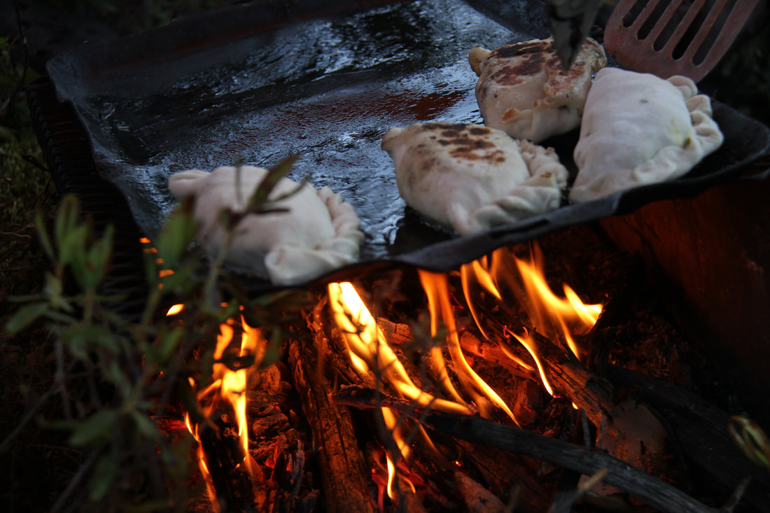
Perogies
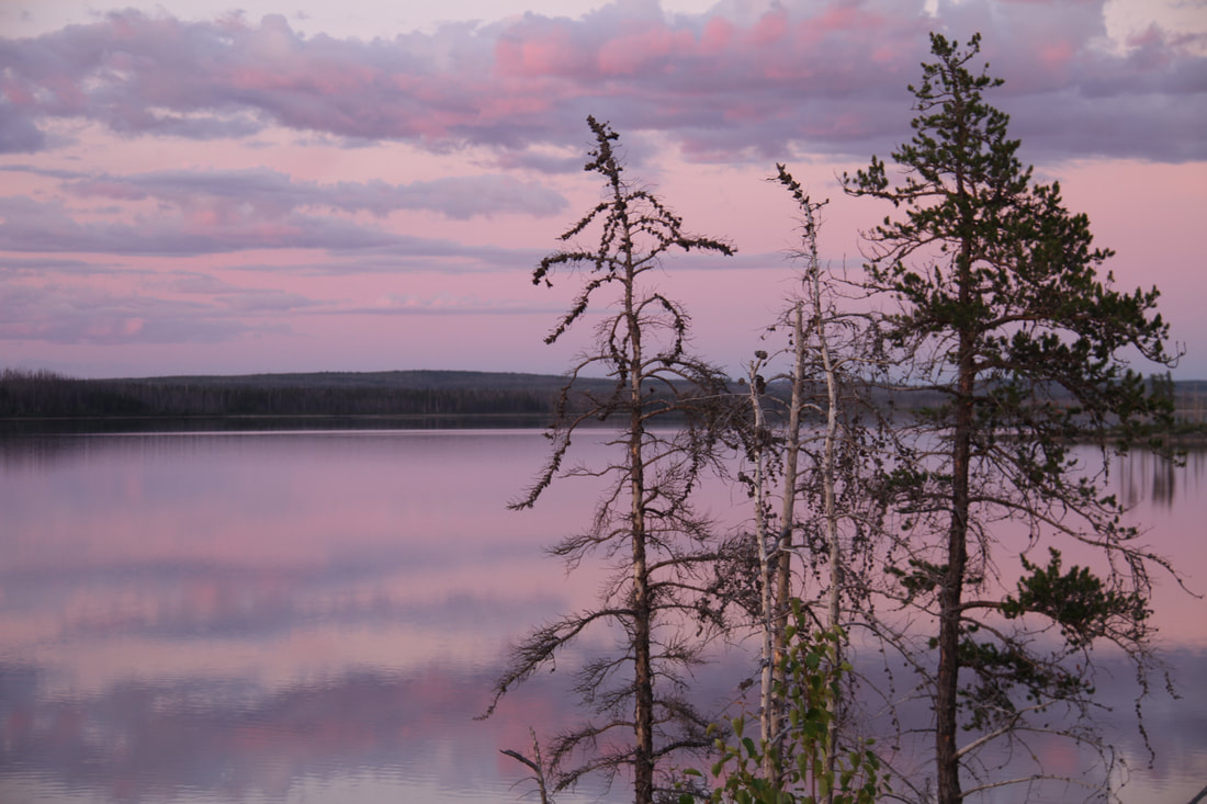
An amazing sunset
|
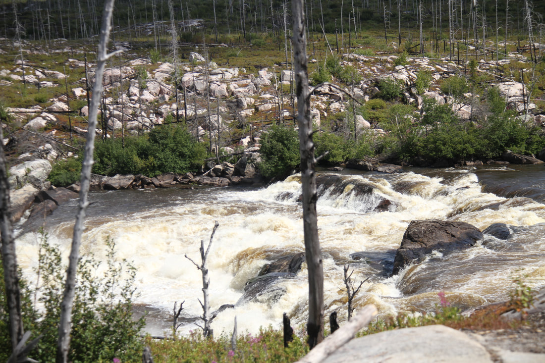
Burnt Hip falls
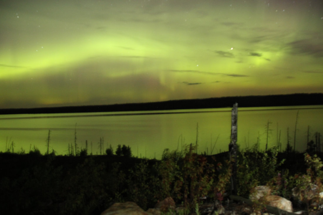
Beautiful display of lights
|
Beautiful
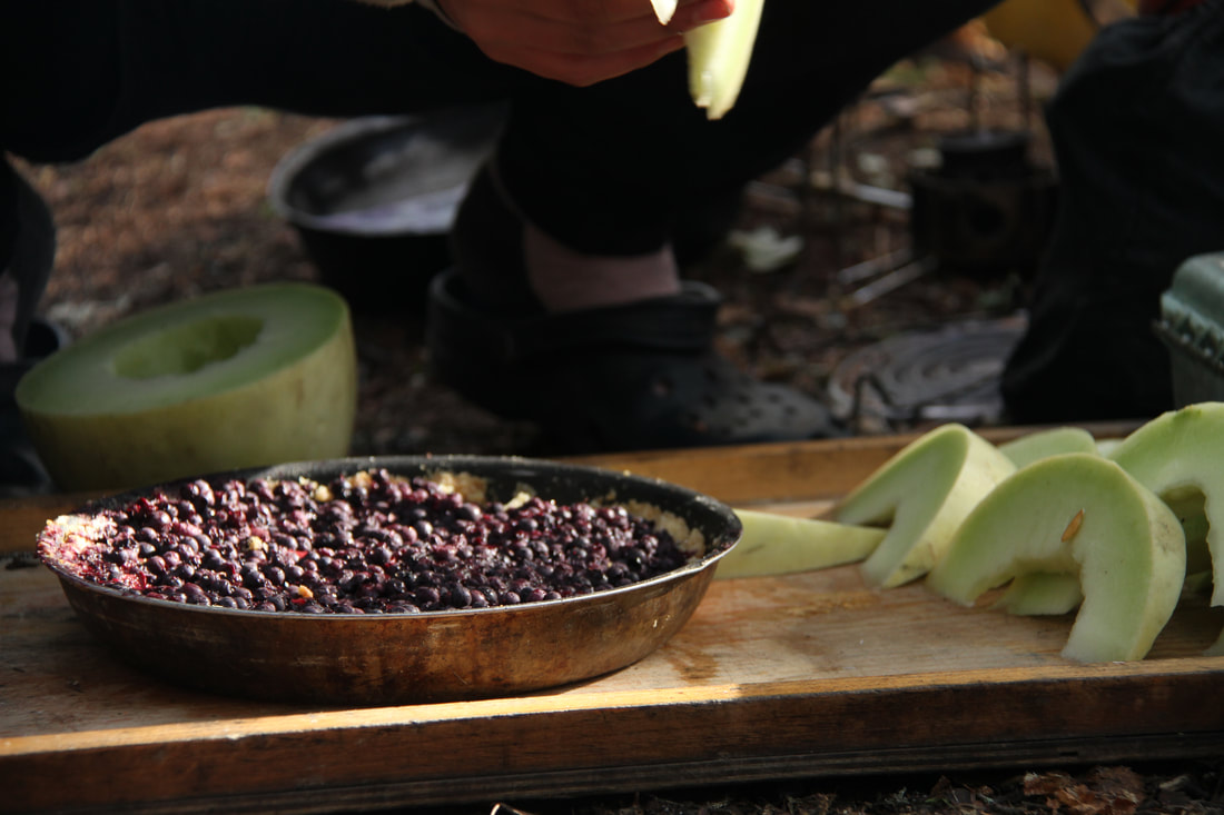
Pie and melon for breakfast. Not pictured granola
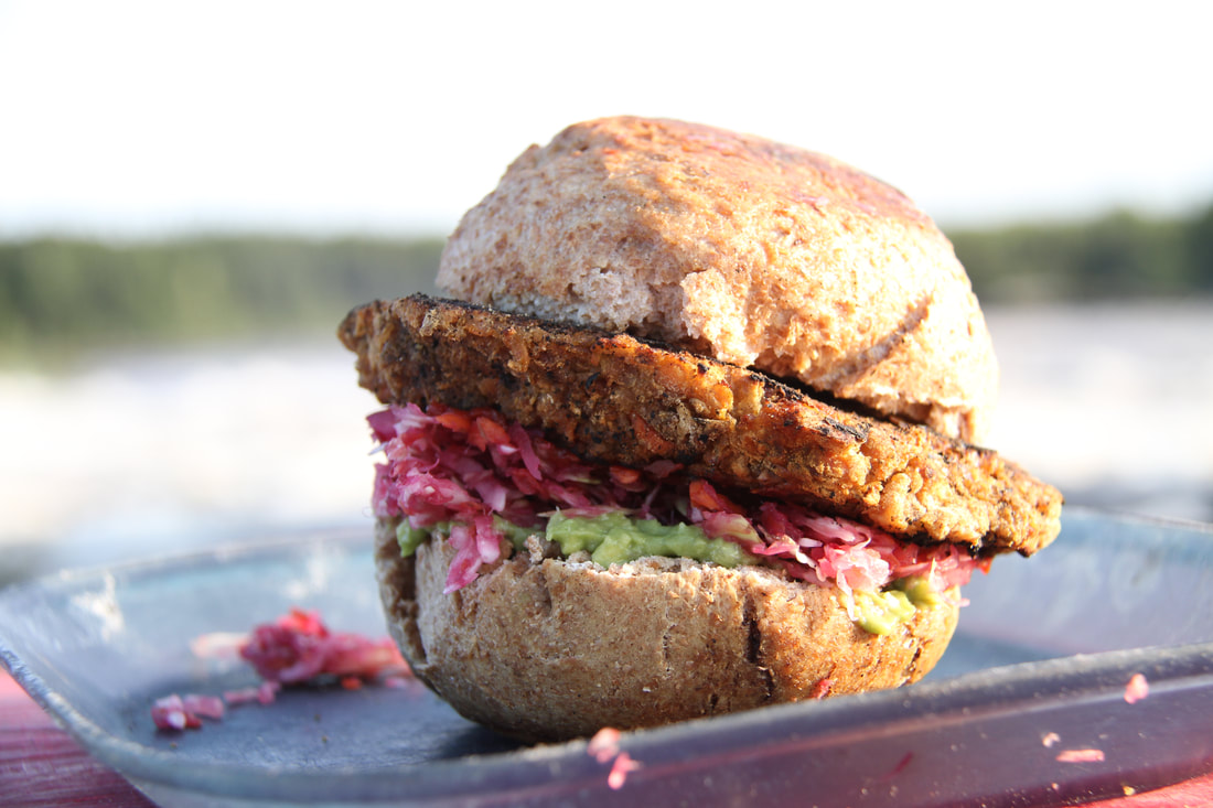
The best burger ever
|

Serenity.
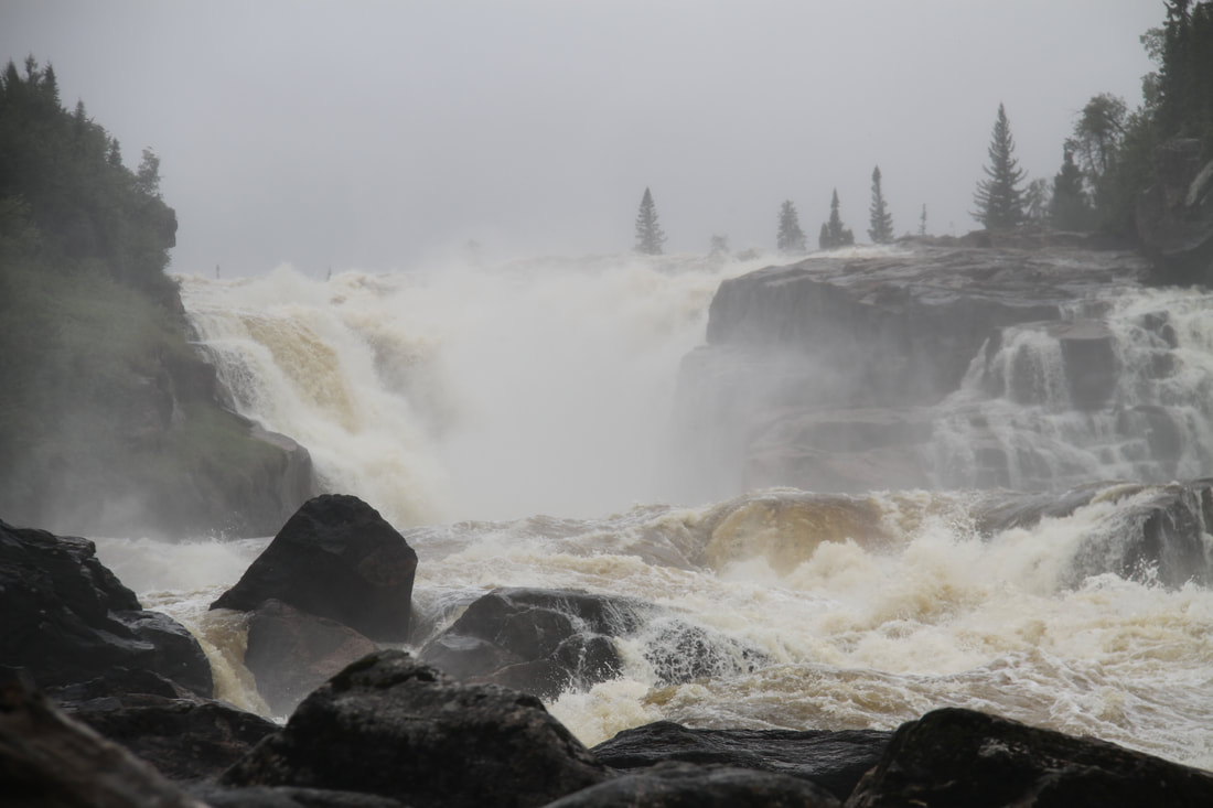
Tupatukasi, also known as the 100 foot waterfall
|
