Getting thereAlthough some people opted to leave their countries during the debacle of 2020, I decided to stay and enjoy the great country that is Canada. Purchasing my first car was a challenging task, but in the end a van was acquired and the drive across the country commenced. For those that have not driven across the country, Ontario is really BIG! for those that have driven across the country, let me remind you that Ontario is BIG! Big, but beautiful. I followed Lake Superior, as I have been on the northern route several times. I had no idea that there where mountains in Northern Ontario (remember mountains are relative, the highest of these is only 600m) the huge cliffs, fiords and mountains kept me entertained as I drove along the coast. Leaving Lake Superior, the land scape begins to change. Flat black spruce country dominates the drive as I entered Manitoba, three days after leaving Ottawa. I opt to drive through Winnipeg that night, camping in a farmers field on the other side. The next day, although monotonous it is very interesting. It has been a decade since I saw the prairies, and the flat treeless scape was more interesting the monotony of the black spruce, only because it was different. The Game of Thrones audio book entertains me through this section. I am now gaging my process based on the completion of this book. so far I have driven most of the way across the country, and yet to have finished the book. I am not sure what is bigger, the book or Canada Turns out Canada is bigger. I camped in Alberta, and completed the first book. On to the second book, and meeting up with my friend Ben
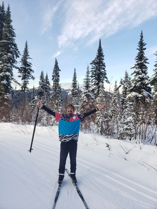
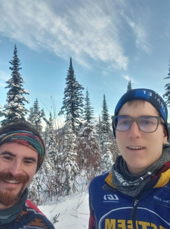
I spent a well need two days resting and relaxing at his house. On the second day we headed out to paddle a frozen Columbia River. It was frozen, but fun frozen. We finished of the day with a photo shoot and dinner at a local restaurant. 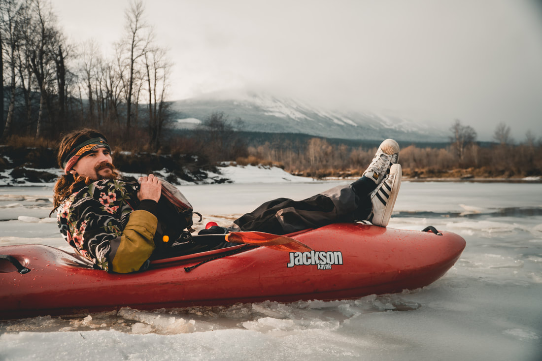 Way too chill. Photo by Ben Baber I left not so early so as to give time for the road to melt. It had rained that night and I was worried that the passes would be dangerous. My aim was Kamloops and my friend Tony's house. I have not seen Tony since our college days, he went west and and I left to travel the world. I spent four lovely days skiing, I have not skied in at least four years. It was so much fun!!
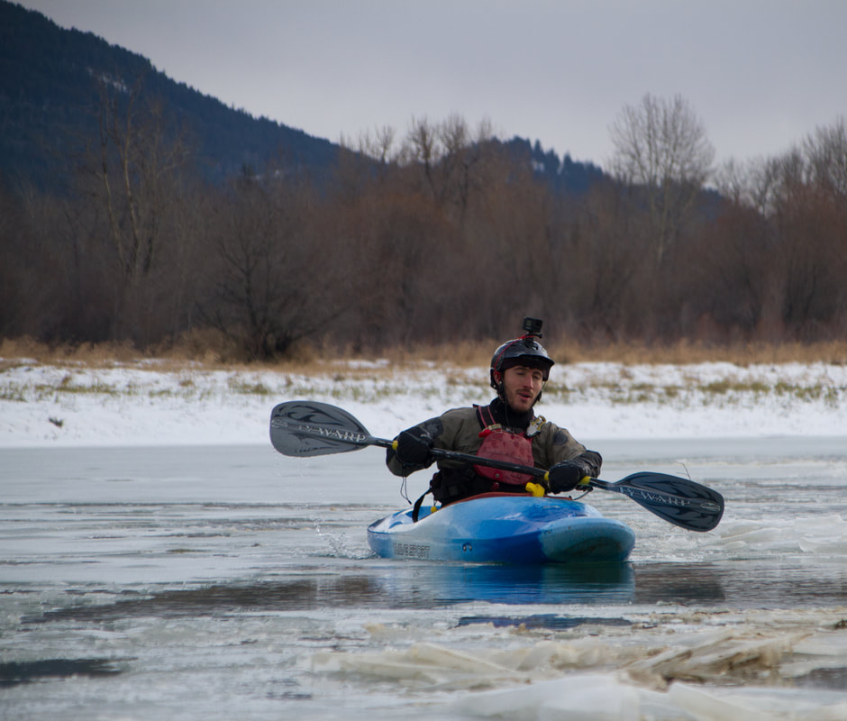
I spent some of my time enjoying the indoor comforts at Tony's house: WIFI, a bed, those things. I also made sure to camp in the area, in order to fully appreciate the surrounding land. I camped next to a small stream with a beautiful waterfall, and chalk full of salmon. I have only ever seen two types of salmon, the type in a can, and the frozen type. It was incredible to see so many live creatures, truly a thing of beauty. leaving Tony's I beelined to the coast, camping beside the ferry terminal. The ferry was uneventful and I spent most of the time reading and listening to the second book in the series A Song of Ice and Fire. From there I beelined up the coast to the small mountain town of Gold River  A classic vista I spent my government mandated quarantine on the logging roads outside of Gold River. In the morning I would paddle the upper Gold River and than walk my kayak 6.5 km back to my car. After lunch I spent my afternoons walking the woods looking for mushrooms and big trees, and there where ample amounts of both. Upon finishing my quarantine I started the drive back to Campbell River, and the coast. Unfortunately my check engine light started flashing. I have a known torque converter problem, I hope that I can just fix that and not have to replace the whole transmission.
37 Comments
General Information
Number of participants: 2 Number of days: 15 Water Level: Low at the top medium high at the bottom. Trip Dates: Two weeks at the end of September into the start of october Total KM: 410 Total Elevation drop: 1750ft Maps used: 1:50000 (23 A/12 west, 23 B/9, 23 B/10, 23 B/7, 23 B/2, 22 O/15 22 O/16, 22 O/8, 22 O/9, 22 O/1, 22 J/16, 22 J/9 22 J/8) Gauge: http://www.cehq.gouv.qc.ca/Suivihydro/graphique.asp?NoStation=072301 General weather: Average for end of September and early October. We had two nights well below zero, and some flurries. consistent rain on the river, which is normal for this river (the name Moisie is French for moldy). We were very lucky on the lakes and only got wind bound for half a day. Pace of trip: Pushed at the start through the lakes, relaxed on the river. Campsites: Mostly bush crash sites throughout the trip, we could always find a cozy mossy den. Lots of burn on the river so it made camping a little easier. We counted only 5 actual established sites on the river, most of which were in a poor state. Route overview: There three main approaches to the Moisie river. They are the Pekans river, the traditional lake approach and the Ashuanipi crossover approach. I have included a breif description of each. 1) Pekans river: The Pekans is the largest river right tributary of the moisie (and possible its largest). You access it from QC route 389 from Baie Comeau to Labrador City. It starts around 2000ft, joining the moisie around 1400ft. It is roughly 100km long and contains a variety of class 2-5 whitewater. The confluence falls are stunning, but a 1500m portage. Logistically this makes more sense with more people, as one could drive to the put in, then put the car on a cargo train to Sept Iles (roughly 450-500$). Below three people it becomes more expensive. Annotated maps for the Pekans approach: http://www.cartespleinair.org/Canot/07/PekansMoisieGoutier2019.pdf http://www.cartespleinair.org/Canot/07/PekansMoisieKovac.pdf 2) Traditional lake approach: Take the train from Sept Iles to the Lab city station (the train no longer runs to lab city, you are put off on the side of the highway) from there, organise a taxi (ideally pre arranged) to pick up you and your equipment and drop it off at Lac deux Miles. These lakes are less big than Ashuanipi, but are still very large. This option takes roughly the same time as the Ashuanipi crossover Annotated map for the traditional lake approach: http://www.cartespleinair.org/Canot/07/DeMilleMoisieGoutier2019.pdf 3) Lac Ashuanipi crossover approach: This is the most physical option. We chose this option because we could not enter Labrador during Covid (I mean we did, just not any cities). This route is great for the following people; those looking for adventure, those that have done the Pekans, and parties less than three. although it is the hardest physically it is the easiest logistically. take the train from Sept iles to station Orway, and off you go. Annotated map for the Ashuanipi crossover approach: http://www.cartespleinair.org/Canot/07/AshuanipiMoisieGoutier2019.pdf Lake Overview: Ashuanipi is a huge lake! It can get very big and windy very fast. We were very lucky we had dead calm and were able to take a big chunk out of it the first day. We planned a half day of being windbound. We could have been wind bound a full day, and could have made the time up on the River. That being said being windbound and slowed more than a couple of days it would start to get dicey. Crossover Overview: the portage is easy to find and follow, at the time of this writing it was very well flagged (thank you, thank you). It is wet and physically challenging. The creak is a drag (literally) Whitewater overview: This is probably one of the best class 3/4 multiday rivers in the world. Overall you want low at the top, high at the bottom. There are a variety of different styles of white water from creaky side channels to supper fun big water rapids. We had low water up at the top, and could have had a wee bit more (half a foot to a foot), and medium high at the bottom. The last days rapids were an incredible 650cms of huge waves, some pushing 12ft tall. It reminded us of high water Lunch Stop waves on the Ottawa River, for 6km. The Moisie floods easily, but can take water. During our last week we saw the river rise about 2ft. The upper section has a creaky vibe and has 3 class 5 rapids, the rest are no harder than 4+, but mostly class 2/3. The River changes to big water after the Pekan river confluence. From here down there are 4 class 5 rapids, all are easily portaged or creaked around. A note on Rapid Katchapahun. It needs very, very low water to be runnable, any amount of rain will likely boost it to an unrunable flow. The portage is a workout, but you have to earn your turns. Schedule: We planned on going for 16 days (plus an extra day of food) we cut it short because it was raining during the good hiking days. we would highly recommend bringing the same amount of food so you can hike. We hiked a lot in 2011 and it was incredible. Sept Iles: Great Town to Start an expedition in. It has everything that you would need, Walmart, Tims Ext. Hot Tip, Gino's has really good pizza, but Marcos in Baie Comeau is better. To sleep; there is a wide variety of hotels and motels, a thriving Tinder scene, the Walmart parking lot, and a quiet little park near the train station. The Train: Take it!!! it is so beautiful out there, never once was our group board. The train ride is absolutely stunning. The flat water is not really that bad (although it can get quite windy), and It also gives you time to figure out your systems for your group; morning rituals, packing your boat and how your boat feels fully loaded. Lastly: YOU HAVE TO EARN YOUR TURNS!!! nuff said. You take the train from Sept Iles to station Orway (7hrs) and is a fixed price of 50$, but your kayak can cost really what ever the person at the desk decides to charge you. Do not call it a kayak, do not call it a canoe. Say it's a wave ski and it's over 4ft long. Hopefully this will cost less than a canoe (140$). We however payed 150 for the kayak, and 10$ extra weight. Trip Report Day 0 HoW: 540-720pm Distance: 5km Weather: clear, light headwinds (from West), Frigid Campsite: 997 267 23 A/12 west (island bush crash across from station) Day 1 HoW: 9-4 Distance: 25km Weather: Dead calm, cool Campsite: 850 250 23 B/9 (esker island, burn) Day 2 HoW: 10-1245 Distance: 7km Weather: Heinous headwinds (from west), cold Campsite: 805 267 (the point) Day 3 HoW: 9-530 Distance: 16km as the crow flys Weather: Annoying side wind (from west), cool and clear Campsite: 668 288 23 B/10 (shitty bush crash in from beach) Tech
Day 4 HoW: 9-3 Distance: 20.5km Weather: Hot, sunny, light wind headwind (from South West) Campsite: 618 104 23 B/7 Tech:
Day 5 HoW: 930-430 Distance: 20km Weather: Overcast, warm Campsite: 525 977 (beautiful hill, amazing!!) Tech:
Day 6 HoW: 9- 440 Distance: 22 km Weather: Mix of sun and clouds, light rain in the aft, cool Campsite: 516 763 23 B/2 Tech:
Day 7 HoW: 10-330 Distance: 29km Weather: Snow (flurries), hovering around zero till the pm when the sun came out Campsite: 682 506 22 O/15 Tech:
Day 8 HoW: 10-4 Distance: 23km Weather: Below zero when we woke up, everything was frozen. Warmed slightly in aft, rain in pm. Campsite: 826 282 22 O/19 Taoti river, actual campsite Tech:
Day 9 HoW: 10-2 Distance: 16km Weather: Rain all day, warmer than the day before, but still cold. Stoped early because of rain. Campsite: 838 107 22 O/9 Old site, amazing view, amazing hiking. Would recommend that you stay here, if only to enjoy the next day’s canyons more. Also there were not a lot of camping options after this for a while. Tech:
Day 10 HoW: 940-3 Distance: 32km Weather: Very warm and sunny Campsite: 897 810 22 O/8 Hot Tip: Keep the camera ready budget time (half day or full day) to hike Tech:
Day 11 HoW: 10:30-330 Distance: 20km Weather: Warm, crazy misty all morning, rain the night before Campsite: 875 600 Haut Moisie Camp Tech:
We slept by the river on the helipad. There is a note on a small cabin by a sandy takeout that says the outfitters are closed for the season but canoe trippers are welcome to use the “small log cabin”. The sign is from 2008. It looked like the sight was in use, but the occupants left the day before. Day 12 HoW: 945-215 Distance: 31km Weather: warm and rainy, strong winds in aft. (from south) Campsite: 827 350 22 J/16 small established site Tech:
Day 13 HoW: 940-330 Distance: 38km Weather: Mix of sun and cloud, cool, wind from south in aft, rain in the evening Campsite: 024060 22 J/9 small beach, great if you like beaches. There are gravel bars a couple km upstream. Tech:
Day 14 HoW: 1045-300 Distance: 23km floated most of the way after the nipissis Weather: mix of sun and cloud Campsite: 014 857 Gare Tellier 22 J/8 Tech:
Day 15 HoW: 10-130 Distance: 25km Weather: Very warm, no wind Campsite: the end Tech:
|
AuthorHi there! Archives
February 2021
|
 RSS Feed
